HiRISE Updates Week of 2017 Oct 09
Posted: Fri Oct 13, 2017 5:46 pm
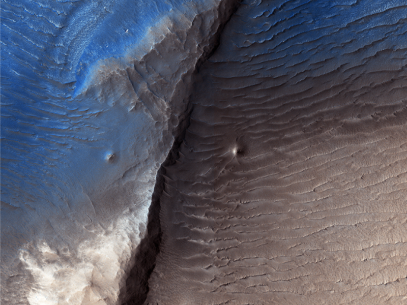
Kirby Runyon wrote:Decoding a Dark Splotch (ESP_016372_1975) (HiClip)
Geologists aren’t quite sure what to make of the dark splotch in the middle of this image, one of several similar dark splotches that extend east and west for over 100 kilometers. From measurements made in infrared, this and other dark splotches have what we call “high thermal inertia,” meaning that it heats up and cools down slowly. Scientists use thermal inertia to assess how rocky, sandy, or dusty a place is. A higher thermal inertia than the surrounding area means it’s less dusty.
Wavy, banded patterns in the dark splotch (possibly due to cross bedding from sand dunes that once occupied the area) were lithified into sandstone, and then eroded away. These clues could help geologists figure out what’s going on there.
This is a stereo pair with PSP_008935_1975.
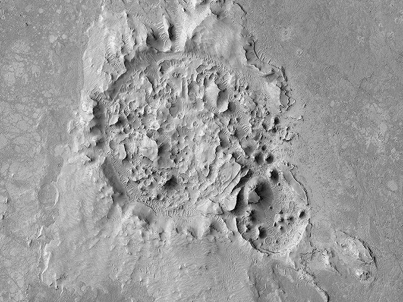
Nicole Baugh wrote:A Highly Disrupted Crater (ESP_051147_1830) (HiClip)
This 2.5-kilometer diameter crater has been significantly altered from the usual bowl-shaped appearance we associate with craters. Material has covered significant portions of the ejecta and filled in the crater. This fill material has since been subject to erosion—like boulders weathering out of the slopes—and the crater rim is also highly irregular.
This crater is located in Elysium Planitia, an area dominated by volcanic processes. It’s likely that the crater fill material is volcanic in origin, and possible that the rim was etched by lava, either flowing into the crater or spilling over after the crater filled completely. However, there are also signs of erosion by wind, like the parallel ridges in the rim breaches and between high-standing regions of the crater fill. It’s likely that the current appearance of this crater is due to a combination of surface processes.
This is a stereo pair with ESP_045319_1830.
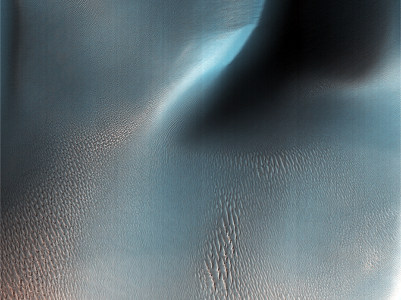
Paul Geissler wrote:Ripples and Dunes in Proctor Crater (ESP_051244_1315) (HiClip)
We find two types of wind (aeolian) features in Proctor Crater: large, dark features that are sand dunes, made up of basaltic particles, and smaller, light-toned ripples that we call “TAR”, or “transverse aeolian ridges.” The origin of the TARs is a mystery. They might be dust deposits, or perhaps coarse grained ripples that are coated in bright dust.
These TARs are less than 10 meters tall, and are much smaller than the sand dunes that reach impressive heights of over 130 meters. In other places on Mars, TARs are generally older than sand dunes, but here in Proctor Crater, it is not so obvious. How can we tell which came first, the TARs or the dunes?
Fortunately, HiRISE has a tool that can solve this riddle. By taking stereo images of the same region from two different locations, we can estimate the topography of the region by measuring the displacement of surface features from one picture to the other. The result is a quantitative estimate of the local surface topography, called a digital terrain model.
If you compare two digital terrain models (Figure 1 and Figure 2, see below) that we’ve made of this same area, it is obvious that the TARs appear at lower elevations in the gaps between the dunes. The dunes are situated on top of the TARs, and with this information, we can say the dunes are clearly the younger formations here in Proctor Crater.
Figure 1 is a DTM of the margin of the Proctor Crater dunes created from previous observations during previous orbits. It is color coded such that blue represents the lowest elevations, followed by green and yellow and red at the highest elevations. Figure 2 is the HiRISE image taken during orbit 4077 (PSP_004077_1325) that has been geometrically corrected to appear as if it was taken from directly above the region.
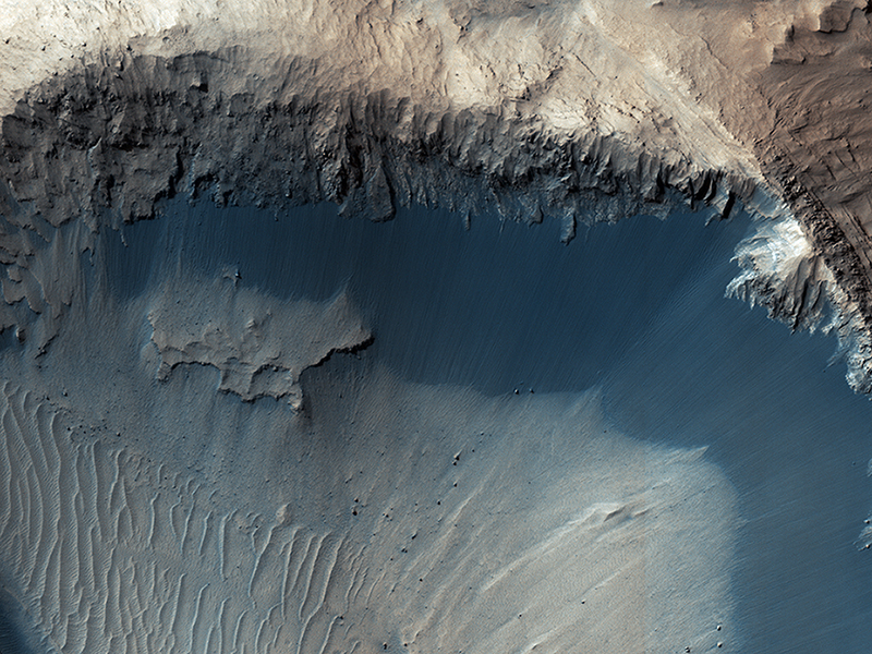
Paul Geissler wrote:Where Does the Sand Come From? (ESP_051780_1725) (HiClip)
The grains of sand that make up sand dunes on Earth and Mars have a hazardous existence because of the way that they travel. Wind-blown sand is lifted above the surface of each planet before crashing onto the ground and bouncing in a sequence of repeated hops, a process called saltation.
Sand grains can also roll along the ground as they are blown by the wind, and they are also jostled by other sand gains that are similarly flying across the surface. All of these repeated impacts tend to wear down the sand grains, smoothing them into a more spherical shape and breaking off small fragments that supply the vast dust deposits of Mars. This process (known as comminution) ultimately destroys sand grains and limits the length of time that the particles exist. The fact that we see active sand dunes on Mars today requires that sand particles must be resupplied to replace the grains that are lost over time. Where are the modern day sources of sand on Mars?
This image shows one possible place where sand grains are being produced on Mars today. Discovered in images from the Context Camera, this region exhibits dark material that is being eroded from dark layers in the bedrock of a semicircular depression near the boundary of the Southern highlands and the Northern lowlands. Downslope lineations support the notion that these dark sediments are derived locally, and did not accumulate here by coincidence because of the winds.
This image and the processes described therein was suggested and studied by Ariana Boyd (University of Tennessee).
Credit: NASA/JPL-Caltech/University of Arizona
<< Previous HiRISE Update


