HiRISE Updates Week of 2017 Apr 17
Posted: Fri Apr 21, 2017 6:26 pm
Alfred McEwen wrote:Secondary Craters in Bas Relief (ESP_049076_1845) (HiClip)
This region of Mars has been sprayed with secondary craters from 10-kilometer Zunil Crater to the northwest.
Secondary craters form from rocks ejected at high speed from the primary crater, which then impact the ground at sufficiently high speed to make huge numbers of much smaller craters over a large region. In this scene, however, the secondary crater ejecta has an unusual raised-relief appearance like bas-relief sculpture. How did that happen?
One idea is that the region was covered with a layer of fine-grained materials like dust or pyroclastics about 1 to 2 meters thick when the Zunil impact occurred (about a million years ago), and the ejecta served to harden or otherwise protect the fine-grained layer from later erosion by the wind.
This is a stereo pair with ESP_049564_1845.
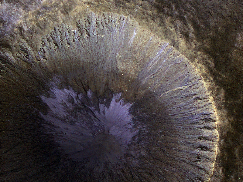
Alfred McEwen wrote:A Winter’s View of a Gullied Crater (ESP_049083_2320) (HiClip)
This is the location with the most impressive known gully activity in the Northern hemisphere. Gullies are active in the winter due to carbon dioxide frost, but northern winters are shorter and warmer than southern winters, so there is less frost and less gully activity.
An enhanced-color image cutout shows recent gullies with bright colors.
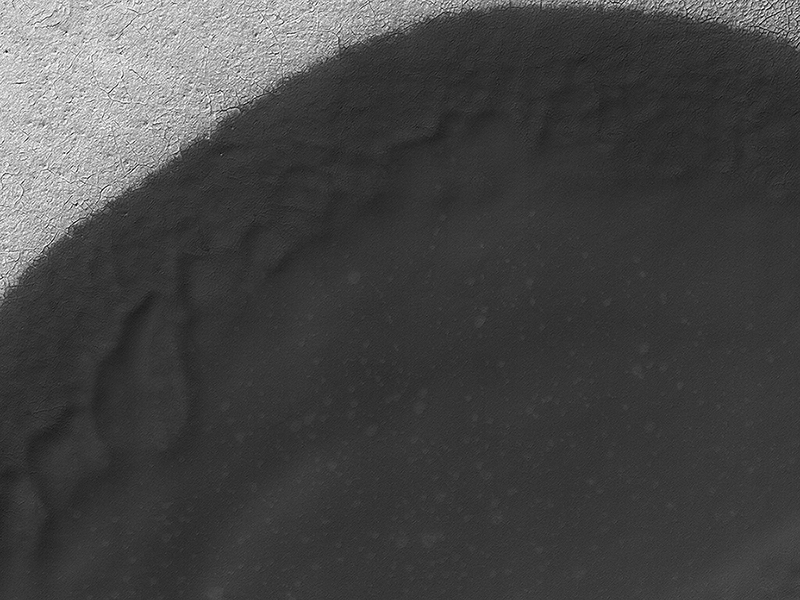
Matt Chojnacki wrote:Dune Transition in the High Southern Latitudes (ESP_049502_1080) (HiClip)
Sand dune populations on Mars can vary widely with respect to morphology, relief, and activity. One of the most striking examples occurs with the many dune fields of the high Southern latitudes.
When we venture south of -60 degrees latitude, we see increasing signs of dune degradation, with subdued dune brinks and broad sandy aprons, rather than sharp, dune crests and distinct boundaries. Dunes this far south are also very modest in height, often consisting solely of flat sand sheets. Additionally, global monitoring campaigns are revealing a noticeable lack of changes in these bedform positions, whereas many dunes and ripples to the north are migrating across the surface.
This image shows a moderate sized dune field (-72 degrees latitude) that displays most of these morphologic features and a noticeable absence of dune crests. This transition is likely related to polar processes, ground ice, and changes in regional climate relative to the rest of the planet.
M. Ramy El-Maarry wrote:It Shrinks! It Cracks! (ESP_049723_1880) (HiClip)
Given enough time, impact craters on Mars tend to fill up with different materials. For instance, some craters on Mars had lakes inside them in the past. When these lakes dried out, they left behind traces of their past existence, such as sedimentary deposits (materials that were carried along with the running water into the lake inside the crater and then settled down). Some craters, especially in high latitudes, contain ice deposits that filled the crater when an earlier ice age allowed ice to extend into the crater’s latitude.
Here, we have a crater that lies close to Elysium, a major volcanic system on Mars. The whole region surrounding the crater was at some point covered by lava from the volcano creating vast lava plains, and in the process, flooding impact craters in their way.
When the lava eventually cooled down, it solidified and began to shrink in size. This shrinking led to formation of cracks on the surface of the lava that grew in a circular pattern matching the shape of the crater it was filling.
Scientists can study these fractures and estimate how much it shrank in volume to better understand the properties of the lava (such as its temperature) during the time it filled the crater.
Credit: NASA/JPL-Caltech/University of Arizona
<< Previous HiRISE Update


