HiRISE Updates (2016 Oct 05)
Posted: Mon Oct 17, 2016 12:05 am
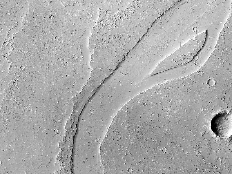
Sarah Sutton wrote:A Long and Winding Channel in Tharsis (ESP_045368_2040) (HiClip)
The Tharsis region of Mars is covered in vast lava flows, many with channels. Some channels, however, resemble features that may have been formed by water.
In this image, we see a smooth, flat-bottomed channel within the roughly irregular edges of a possible lava flow. This long, winding channel runs for 115 kilometers (70 miles) from its source (shown in ESP_045091_2045), maintaining a nearly consistent width. There is also a streamlined island within the channel, which is 1.25 kilometers (about 3/4 mile) long.
One possibility is that a lava flow formed, and later groundwater was released, preferentially flowing through and further eroding the pre-existing lava channel. Or, the original lava flow could have been a very low-viscosity lava. We look at the shape and profile of the channel, and the channel and lava flow edges, to understand the characteristics of the fluids at work. Although there are lava flows and rivers on Earth that we can observe to understand the processes at work, the interplay of the features on Mars may tell a more complicated story.
We want to be able to understand the history of volcanic activity in Tharsis, as well as possible interaction with ground water release, to better understand some of the younger landforms on Mars.
This is a stereo pair with ESP_046436_2040.
Cathy Weitz wrote:Deposits along the Northern Wall of Melas Chasma (ESP_045960_1705) (HiClip)
It has been known since the 1970s when the Viking orbiters took pictures of Mars that there are large (i.e., several kilometers-thick) mounds of light-toned deposits within the central portion of Valles Marineris. More recent higher resolution images of Mars, including this image of Melas Chasma, show that the wall rocks of Valles Mariners also contain similar, albeit thinner, light-toned deposits.
Spectral data from the CRISM instrument indicate that the larger mounds are composed of sulfates. Some of the wall rock deposits are also made up of sulfates, but others contain clays or mixtures of several kinds of hydrated materials, suggesting that multiple aqueous processes, perhaps at different times within Valles Marineris, formed the variety of deposits we now observe.
Cathy Weitz wrote:A Transition from Depressed to Inverted Channels in Gorgonum Basin (ESP_046201_1430) (HiClip)
This image shows a transition from depressed to inverted channels in the Gorgonum Basin. In the darker terrain, there are two channels that display depressed topography. As these two channels cross into the underlying brighter terrain, the channels now stand above the surrounding area, indicating they are inverted in topography.
This change from depressed to inverted topography is the result of what is called “differential erosion.” The channel may contain hardened sediments or have cements that make it more resistant to erosion relative to the darker terrain that once flowed through it. As a result, erosion has removed the less resistant upper darker terrain, leaving behind the more resistant channel standing above the underlying bright terrain.
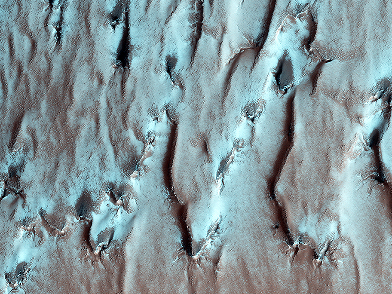
Ross Beyer wrote:On the Edge of the South Pole Layered Deposit (ESP_047087_1065) (HiClip)
This image shows the edge of the Martian South Polar layered deposit. The stack of fine layering is highlighted by the rays of the polar sun.
These layers show the pervasive red coloring of Mars which have built up over the ages. While this is a polar deposit, no ice or frost is visible on these layers, as they face the sun. However, if you look beyond the rim of the layered slope at the 'top' of the deposit, you can see that red rock and dust are covered with frost, as well as small radial channels that are evidence of polar spider networks.
Credit: NASA/JPL-Caltech/University of Arizona
<< Previous HiRISE Update


