HiRISE Updates (2015 Sep 30)
Posted: Tue Oct 06, 2015 3:36 pm
Shirley (Sunny) Rosendahl and Marjorie A. Chan wrote:Aeolian Features of Scandia Cavi (ESP_017426_2570) (HiClip)
This HiRISE image shows modified barchan dunes with shapes that resemble “raptor claws.” The unusual morphology of these dunes suggests a limited supply of windblown sand.
Winds likely blew from the northeast resulting in elongate dunes with an asymmetric downwind point. The transverse crests of the smaller ripples/mega-ripple bed-forms surrounding the dune, echo the dominant downwind direction towards the southwest.
This locality is in the Northern Lowlands directly east of Dokka Crater in Scandia Cavi.
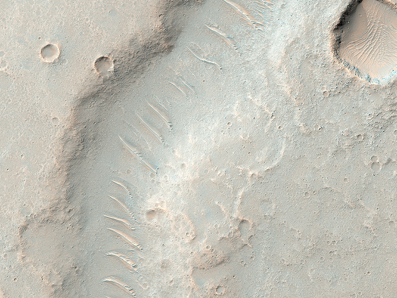
Mike Mellon wrote:All Along the Fractures (ESP_042223_1890) (HiClip)
We often take images of sand dunes to study the mobile soils. These images provide information about erosion and movement of surface material, about wind and weather patterns, even about the soil grains and grain sizes. However, looking past the dunes, these images also reveal the nature of the substrate beneath.
Within the spaces between the dunes, a resistant and highly fractured surface is revealed. The fractured ground is resistant to erosion by the wind, and suggests the material is bedrock that is now shattered by a history of bending stresses or temperature changes, such as cooling, for example.
Alternately, the surface may be a sedimentary layer that was once wet and shrunk and fractured as it dried, like gigantic mud cracks. In either case, the relative small and indistinct fractures have trapped the dark dune sand marching overhead. Now the fractures have become quite distinct, allowing us to examine the orientation and spacing of the fractures to learn more about the processes that formed them.
Kirby Runyon wrote:Nested Channels near Hellas (ESP_042433_1535) (HiClip)
We’re not sure if this channel-inside-a-channel was carved by flowing water or lava. Flowing water erodes channels, and flowing lava both erodes and melts surrounding rock to form channels.
It's not clear whether a huge surge of water or lava first formed the wide channel and then subsided into a trickle to form this narrow, inner channel, or if a trickle formed the inner channel and a subsequent surge formed the wider one. Detailed analysis of the shape could reveal which scenario is most likely, as well as whether water or lava is responsible. Relevant observations for such a determination would include, for example, the facts that the channels lack levees (ridges along the banks) and that the inner channel diverts around a mound, which at one time was an island.
This channel system flowed to the southwest toward the huge Hellas impact basin.
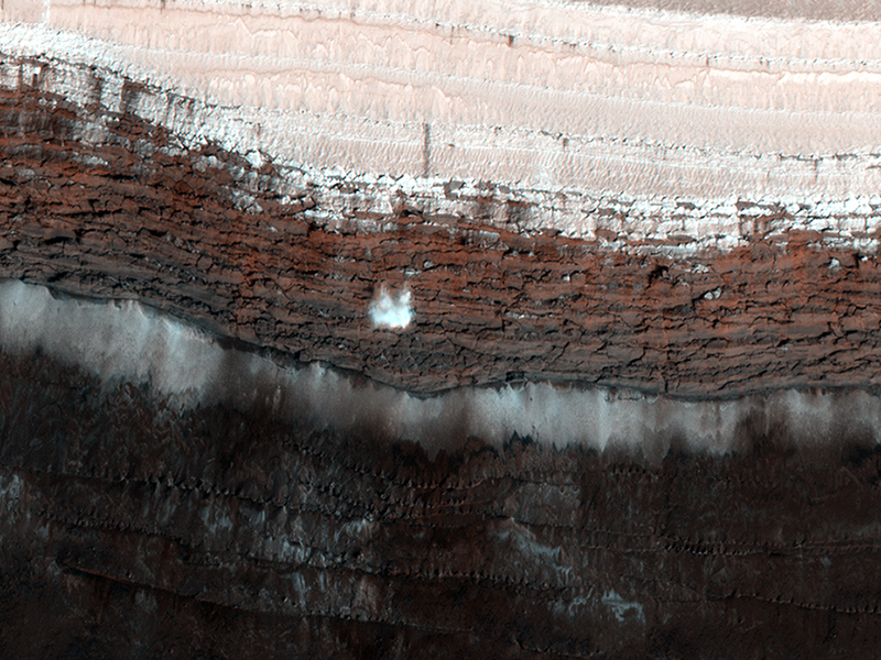
Paul Geissler wrote:Dynamic Mars (ESP_042572_2640) (HiClip)
This scarp at the edge of the North Polar layered deposits of Mars is the site of the most frequent frost avalanches seen by HiRISE. At this season, northern spring, frost avalanches are common and HiRISE monitors the scarp to learn more about the timing and frequency of the avalanches, and their relationship to the evolution of frost on the flat ground above and below the scarp.
This picture managed to capture a small avalanche in progress, right in the color strip. See if you can spot it in the browse image, and then click on the cutout to see it at full resolution. The small white cloud in front of the brick red cliff is likely carbon dioxide frost dislodged from the layers above, caught in the act of cascading down the cliff. It is larger than it looks, more than 20 meters across, and (based on previous examples) it will likely kick up clouds of dust when it hits the ground.
The avalanches tend to take place at a season when the North Polar region is warming, suggesting that the avalanches may be triggered by thermal expansion. The avalanches remind us, along with active sand dunes, dust devils, slope streaks and recurring slope lineae, that Mars is an active and dynamic planet.
Credit: NASA/JPL-Caltech/University of Arizona
<< Previous HiRISE Update


