HiRISE Updates (2014 Dec 17)
Posted: Fri Dec 26, 2014 5:26 pm
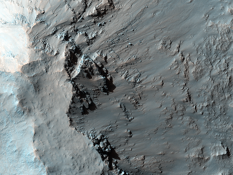
Ryan Hopkins, Livio Tornabene, Eric Pilles, Kayle Hansen wrote:Possible Opaline Silica in the Central Uplift of Elorza Crater (ESP_033722_1710) (HiClip)
Elorza Crater is an approximately 40-kilometer diameter complex crater located at 304.8 degrees east, 8.76 degrees north, about 300 kilometers north of Coprates Chasma. This image centers on the southwestern portion of the central uplift, and is characterized by numerous bedrock exposures and coherent impact melt flows.
The distinguishing feature of this central uplift is the various types of bedrock that are observable at the surface. This image shows uplifted massive fractured bedrock that is visible directly adjacent to dark-toned flow materials, which are interpreted to be impact melt flows.
At full resolution, it is possible to distinguish the stratigraphic relationship between these two units; the impact melt appears to be eroding up the slope, exposing the underlying bedrock. Examining an image from the Compact Reconnaissance Imaging Spectrometer for Mars (or CRISM, another instrument on MRO), a spectral signature can be observed that strongly correlates with this exposed bedrock, which is consistent with opaline silica.
Directly northwest of this feature is uplifted bedrock with distinct intact layering, a common feature visible in central uplifts of impact craters near Valles Marineris. Understanding where each bedrock unit originated, and how it was subsequently exposed during the impact process, is a complex problem that relies upon synthesizing several remote sensing data sets available for Mars.
Refer to the caption for ESP_021551_1710 for an image covering almost the full width of Elorza's central uplift.
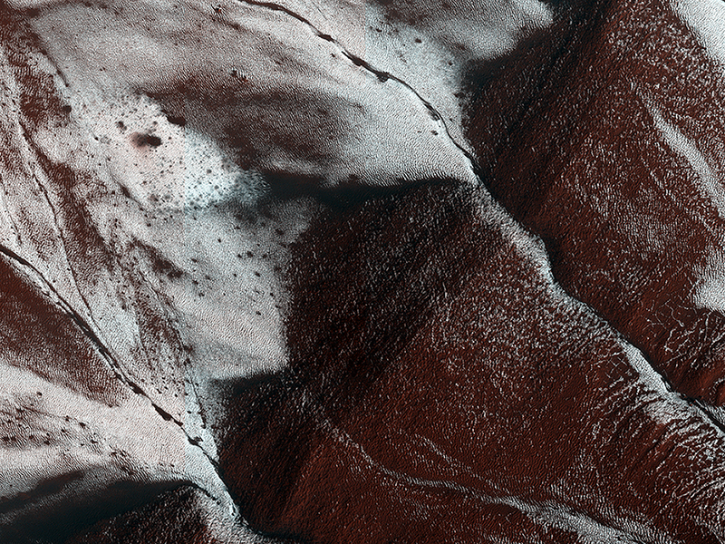
Livio Tornabene, Ryan Hopkins, Kayle Hansen, Eric Pilles wrote:Frosty Slopes in Late Spring (ESP_039114_1115) (HiClip)
This HiRISE image, approximately 1.5 by 3 kilometers, shows frosted gullies on a south-facing slope within a crater.
At this time of year only south-facing slopes retain the frost, while the north-facing slopes have melted. Gullies are not the only active geologic process going on here. A small crater is visible at the bottom of the slope.
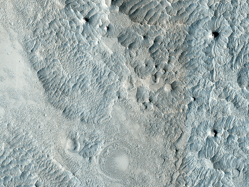
Livio Tornabene, Eric Pilles, Ryan Hopkins, Kayle Hansen wrote:Eroding Terrain in Arabia Terra (ESP_039113_1915) (HiClip)
This image, approximately 1.5 x 3 kilometers, shows a sample of eroded Martian terrain in Arabia Terra.
At one time this was a flat smooth terrain, but over time it has been eroded (most likely by the wind) forming depressed, low-lying areas where we see many small dunes. The dunes resemble waves in the ocean, whereas in other areas we see small flat-top hills forming.
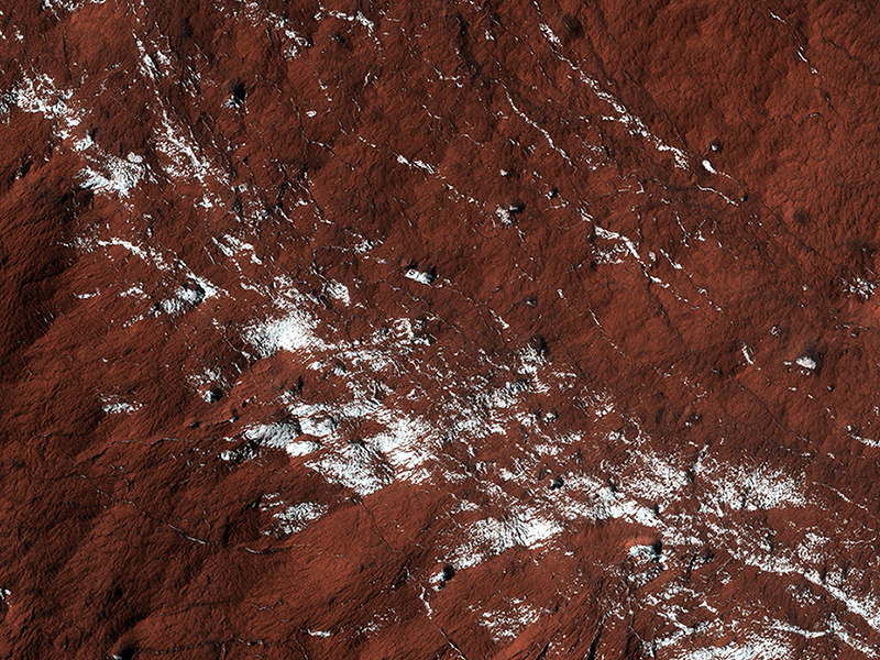
Livio Tornabene, Eric Pilles, Ryan Hopkins, Kayle Hansen wrote:Polar Layered Deposit Slopes (ESP_039122_1080) (HiClip)
This image, approximately 500 by 500 meters, represents a popular monitoring site; in this case a sample of the South Polar layered deposits (SPLD).
These deposits are quite extensive and partially surround the South polar residual cap. In this beautiful enhanced color image we see fractured bedrock partially coated in carbon dioxide frost.
Credit: NASA/JPL/University of Arizona
<< Previous HiRISE Update


