John Bridges wrote:Glaciation at the Eastern Hellas Margin (ESP_036947_1390) (HiClip)
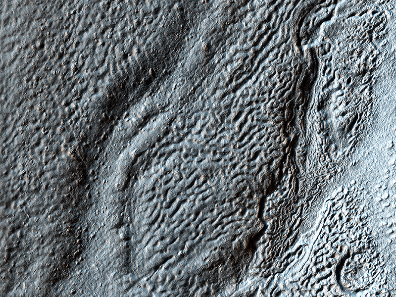
Hellas Crater in the ancient highlands contains some of the clearest evidence on Mars for glacial processes. This image, on the eastern margin of the giant impact crater, shows a number of features consistent with glaciation.
There are roughly north-south running ridges and troughs which mark the deposition of sediment called moraine underneath or beside a glacier. There are also sinuous channels which may formed from meltwater underneath a glacier. A small (3.5 x 3.5 kilometer) cutout shows an example of the moraine and meltwater channel.
John Bridges wrote:The Side of Chasma Boreale (ESP_037056_2650) (HiClip)
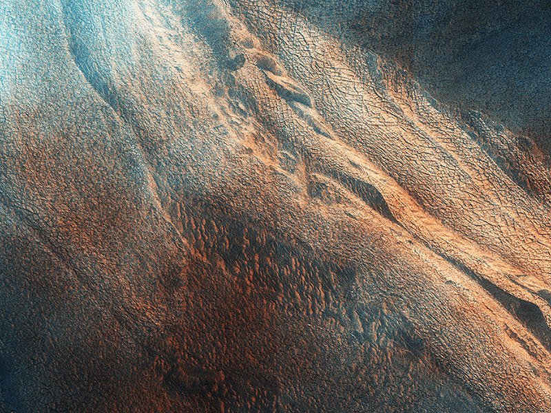
Chasma Boreale is the 560-kilometer long valley that cuts through the Northern Polar layered deposits of Mars.
The section that it exposes show fine scaled layering and a major unconformity, where the azimuth of the beds changes markedly. This is is characteristic of the polar layered deposits. The formation of the unconformity suggests a time when the lower sediments were being eroded rather than deposited. The extracted image shows a roughly 4 x 4 kilometer area across the unconformity.
The polar layered deposits are weakly cemented rocks, and so lying over the scarps you can see lines of mass wasting where dust and sand size particles have slumped downhill. This image is part of a planned stereo pair, and was in the late summer in the Northern Hemisphere of Mars.
Comparing images like this to those taken in previous years and in different seasons allows a more accurate understanding of current surface processes on the Red Planet.
This is a stereo pair with ESP_036515_2650.
Alfred McEwen wrote:An Irregular, Upright Boulder (ESP_037190_1765) (HiClip)
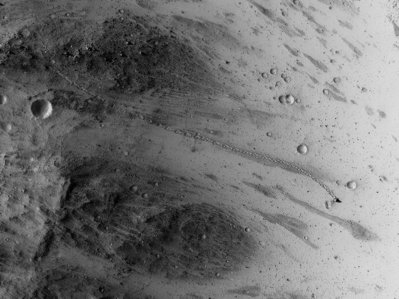
This image was targeted to cover part of a small “chaos” terrain, where there are lots of steep slopes.
A closeup shows a boulder or block casting a long shadow, at the end of a boulder trail down the slope, and we can see it moved from upper left to middle right. The trail has a odd repeating pattern, as if the boulder couldn't roll straight due to its shape.
The sun angle and shadow length indicate the boulder is about 6 meters high, whereas its width as seen from overhead is only about 3.5 meters, so indeed it has an irregular shape. Furthermore, it came to rest with its long axis pointed up.
This is a stereo pair with ESP_035700_1765.
Alfred McEwen wrote:Strange Cones and Flows (ESP_037222_1820) (HiClip)
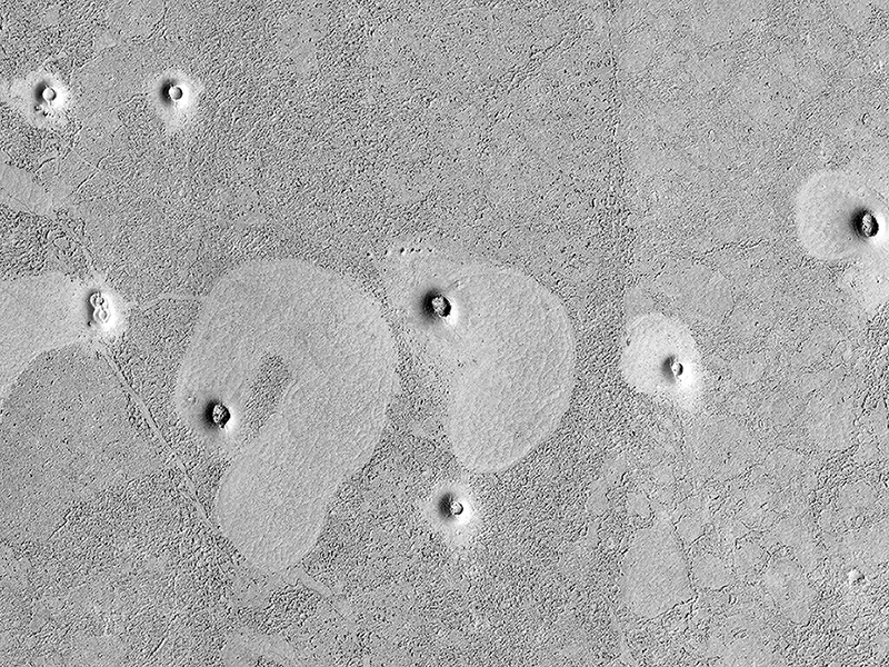
The north end of this long image shows a lava surface in southern Elysium Planitia. Small cones are common on the extensive young flood lavas in this region.
Here, the cones are larger than usual, perhaps approaching cinder cone sizes. What's really odd here is that the cones are associated with lighter areas with polygonal patterns. Such polygons are commonly visible on the denser portions of lava flows, while the rougher areas have more broken-up low-density crust.
But the shapes of these regions are unusual, and the association with cones suggest that the cones were source vents for local lava flows. Other interpretations are also possible.
Credit: NASA/JPL/University of Arizona
<< Previous HiRISE Update


