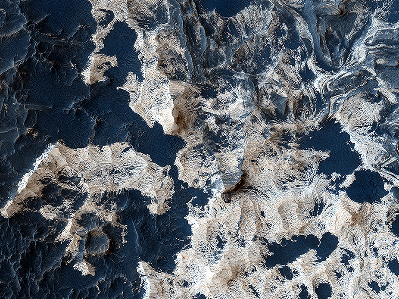
Cathy Weitz wrote:Water-Bearing Rocks in Noctis Labyrinthus (ESP_036598_1735) (HiClip)
The bright rocks in this image have minerals that contain water. These water-bearing minerals are found using the companion instrument on the MRO spacecraft called CRISM.
By combining the spectral data from the CRISM instrument with the high resolution visible images taken by HiRISE, scientists are able to speculate how water deposited and/or altered these rocks.
Many of the depressions in Noctis Labyrinthus contain water-bearing minerals, suggesting that water was available and persistent in this region during the Late Hesperian to Amazonian epochs on Mars, a time when the climate is believed to have been dry and cold like we see today.
This is a stereo pair with ESP_036743_1735.
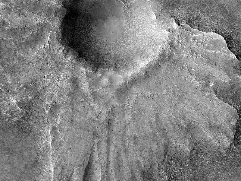
Patrick Russell wrote:Preserving Ice from a Vanished Terrain (ESP_036815_2330) (HiClip)
This HiRISE image shows what is termed a pedestal crater, so-called because the level of the surface adjacent to the crater is elevated relative to the surface of the surrounding terrain.
The raised surface has patterns and a general outline resembling what ejecta would look like after being thrown out from the crater by the impact. This impact probably occurred at a time when the surface of the whole scene was at the level of the raised surface. The ejecta landed on the part of this surface close to the crater. Erosion then removed material in the rest of the scene while the impact ejecta shielded the area around the crater, protecting the ground under it from eroding and keeping it high.
The eroded, or “missing”, terrain in the rest of the scene may have contained ice. Lobe shapes at the base of the raised ejecta and polygons (visible when zoomed in) on the surface both suggest the pedestal material may have, or may still, contain ice. The pattern of ejecta is asymmetric around the crater, suggesting the impactor may have hit the ground traveling from the north-east.
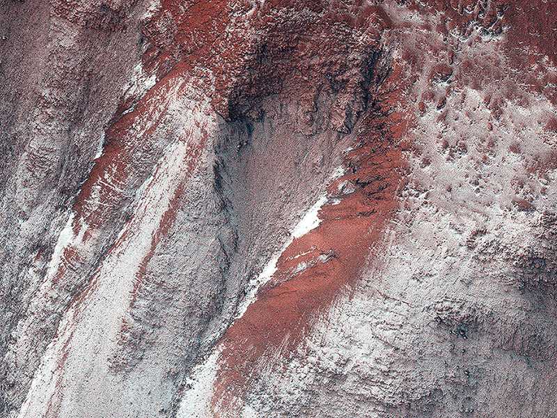
Alfred McEwen wrote:Frosty Gullies (ESP_037137_1360) (HiClip)
HiRISE monitoring has shown that gully formation on Mars occurs in winter and early spring in times and places with frost on the ground.
This image was acquired in late winter, and the frost or ice (visible as white areas) persists only on the south-facing slopes that have received little direct sunlight to this date.
Ridges between gully alcoves that get more light are reddish and largely free of frost. New gully activity isn't obvious in this image. There may be a delicate balance: in some years the frost (up to approximately 1 meter thick) will trigger avalanches, but not in most years. This frost consist of mostly carbon dioxide (dry ice), but includes small amounts of water ice as well.
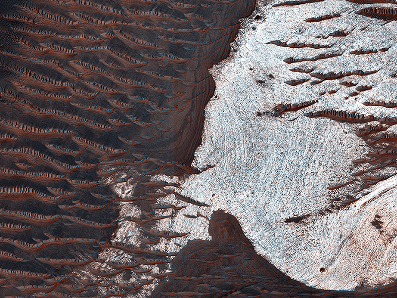
Alfred McEwen wrote:Layers and Sand on the Floor of Schiaparelli Crater (ESP_037161_1785) (HiClip)
Schiaparelli Crater is a 460 kilometer (286 mile) wide multi-ring structure. However, it is a very shallow crater, apparently filled by younger materials such as lava and/or fluvial and aeolian sediments.
Most of the floor is covered by a thin layer of dust, but in places where there are patches of dark sand, there is also well-exposed bedrock. This sand-bedrock association is commonly seen on Mars, and most likely, the sand is actively saltating (hopping in the wind) and kicks off the dust.
The enhanced-color cutout reveals the relatively bright bedrock, which has a morphology similar to other deposits on Mars interpreted as “dust-stone”, or ancient dust deposits that have been hardened into coherent bedrock.
In summary, one interpretation is that actively-moving sand kicks off the loose dust so we can see the hardened dust.
Credit: NASA/JPL/University of Arizona
<< Previous HiRISE Update


