HiRISE Updates (2013 Sep 12)
Posted: Sat Sep 14, 2013 4:44 am
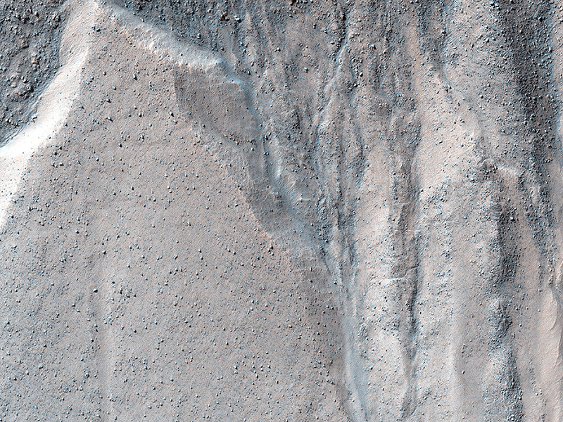
HIRISE Science Team wrote:Gullied Massif in the Nereidum Montes (ESP_032522_1345) (HiClip)
This observation shows a beautiful example of gullies in a massif in Nereidum Montes, located in Argyre Planitia, one of the largest impact basins on Mars.
The purpose of acquiring this full-resolution image of these gullies was to take a closer look at where they are originating from in the massif wall. If we can answer that, we might be able to learn what were the processes that actually formed these gullies. In this particular region, there might be indications of a glacial past.
Nereidum Montes extends approximately 1150 kilometers, and was named by the noted Greek astronomer Eugène Michel Antoniadi (1870-1944).
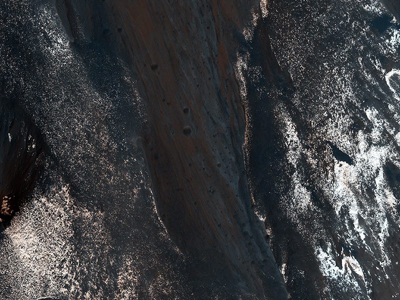
HIRISE Science Team wrote:Slope Lineae along Coprates Chasma Ridge (ESP_032562_1670) (HiClip)
The formation of "recurring slope lineae" is a fascinating process on Mars that we're just beginning to investigate, and one that we've imaged before in Palikir Crater.
These RSLs show up in the spring and fade in the winter. Their presence might be due to briny water, and it opens up the door to taking a fresh look at other possible RSL candidates. This observation was done to accomplish just that: to re-image a previously photographed area that might confirm if this a candidate for RSL.
When HiRISE re-images an area, we try to match the exact lighting as before, in order to see any differences. Along with a stereo pair and resulting anaglyph, our understanding of the terrain is more complete.
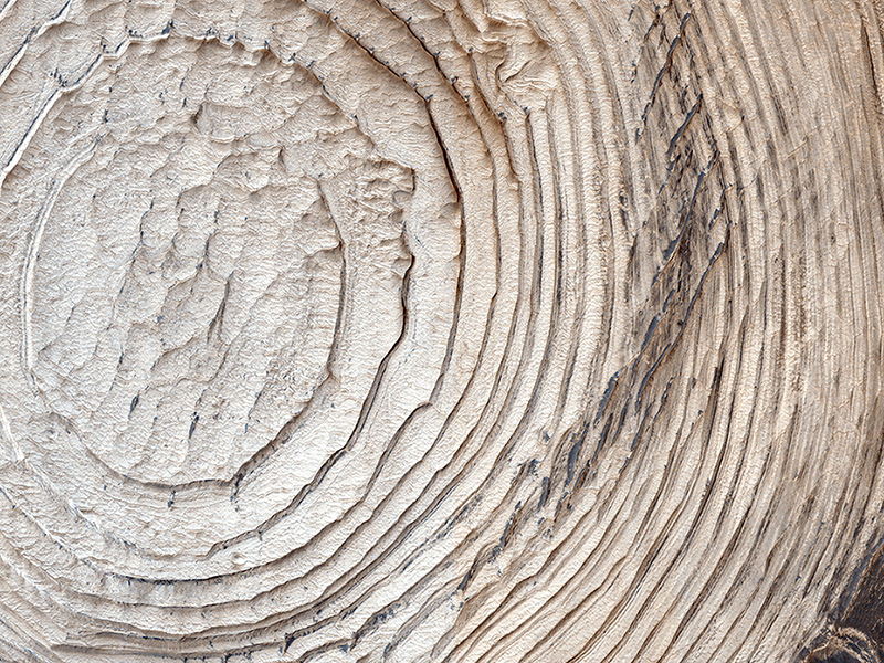
Nathan Bridges wrote:Layers, Bedrock Ridges, and Dark Sand in Schiaparelli Crater (ESP_032836_1790) (HiClip)
Like any diverse group of explorers, scientists on the HiRISE team and the general public who submit target suggestions have different goals and interests for the Mars images they hope to get. More often than not, an image intended for one particular science investigation ends up having many other applications, answering and raising new questions.
This image was targeted to look at potential changes in the distribution of dark sand compared to earlier pictures (PSP_005897_1790 three Mars years ago and ESP_016406_1790/ESP_017118_1790, approximately 1.5 Mars years ago). In a preliminary investigation, no such changes have been found, although we will keep looking.
Originally, this area—a crater within the larger Schiaparelli Crater—was targeted to investigate the circumferential layers that fill the crater, evidence for possible past deposition from airfall dust or even water. In this image, we note something that becomes apparent if we zoom in to many of the areas containing dark sand. Here, the sand is on top of periodic bedrock edges oriented semi-radially from the crater and approximately perpendicular to the layers. How did these ridges form, and what is the relationship to the sand?
The ridge origin is a mystery, but the sand may simply be nucleating on the ridges. This suggests that some apparent large ripples on Mars are sand nucleation sites on pre-existing topography. The extent of such ridges, and their relationship to sand elsewhere on the planet, can be further understood with future HiRISE images in other areas.
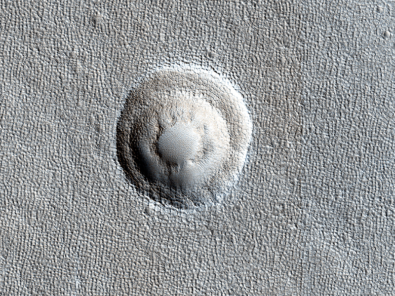
Shane Byrne wrote:Terraced Craters and Layered Targets (ESP_033014_2260) (HiClip)
Small impact craters usually have simple bowl shapes; however, when the target material has different layers of different strength, then more complicated crater shapes can emerge.
The most common situation is a weaker layer overlying a stronger one. In that case, these craters usually have a terrace on their inner walls where the crater abruptly becomes smaller at the depth where this change in material occurs.
In this image of Arcadia Planitia, we can see one of these terraced craters. In fact, there are two distinct terraces implying at least three distinct layers in this target. Images like this help scientists probe the near subsurface of Mars. In this case, the different material strengths are probably caused by layers of ice (weak) and rock (strong).
Credit: NASA/JPL/University of Arizona
<< Previous HiRISE Update


