HiRISE Updates (2012 Feb 22)
Posted: Wed Feb 22, 2012 7:29 pm
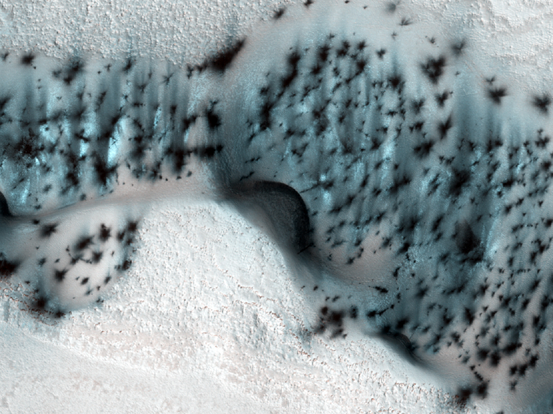
Serina Diniega wrote:Well-Speckled Polar Dunes (ESP_025579_2580)
These barchan (crescent-shaped) sand dunes are found within the North Polar erg of Mars. This type of dune provides a great record of the wind environment when they formed and moved: barchan dunes' horns point downwind. Although the question of present-day sand motion is still open, it appears possible that these dunes are active (when not covered in frost) as their crestlines are very sharp and their slipfaces (the inner curved region between the horns/downwind surface) appears very smooth and steep.
In this image, taken during the northern spring season, the dunes and ground are still covered in seasonal frost. The speckled appearance is due to the warming of the area -- as the carbon dioxide frost and ice on the dunes warms, small areas warm and sublimate (turn from solid to gas) faster, creating small jets that expose/deposit dark sand and dust onto the surface. Notice that there are no spots on the ground between the dunes -- that is because the ground stays more uniformly cold, unlike the darker dune sand.
As spring continues, more spots will appear on the dunes until, suddenly, all of the frost on the dunes and ground will be gone and the dark dune sand will be exposed until next winter.
Alfred McEwen wrote:Utopia Planitia Scallops, Polygons, and Boulders (ESP_025620_2275)
This terrain is covered by pits and scallops (pits open on one side), perhaps due to collapse after sublimation of subsurface ice.
This full-resolution anaglyph sample shows that the surface is cut into many polygons about 10 meters wide, that form as ice expands and contracts with temperature changes. There are also many meter-scale boulders on the surface, which must be rocks rather than blocks of ice, or they would not be stable on the surface.
More than 10 meters thickness of ice must have sublimated from some areas. (Sublimation is the process of going from a solid directly to a gas). How did the ice get deposited? One idea is that it's from snowfall (in a different climate), but then it is difficult to explain the presence of the boulders. The other possibility is transport through the shallow subsurface in very thin films of water over many years.
This is a stereo pair with ESP_025277_2275.
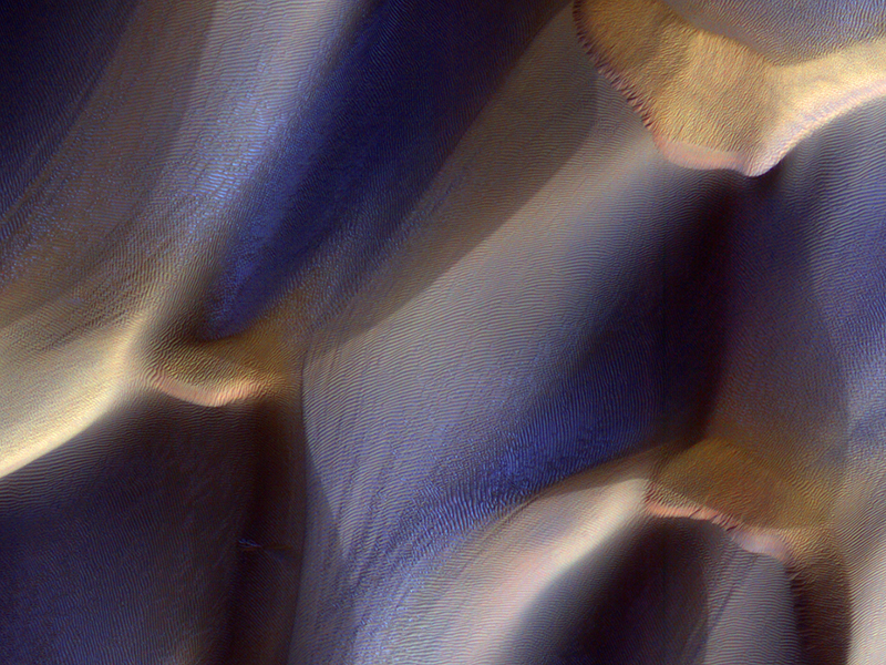
Alfred McEwen wrote:Dunes in Late Fall: Frost in the Ripples (ESP_025679_1300)
These dunes in Aonia Terra are being monitored for changes such as gullies, which form over the winter from the action of carbon dioxide frost.
The season in which this image was acquired was late fall in the Southern hemisphere. Frost is just starting to accumulate here, and is concentrated on pole-facing slopes and in the troughs between the meter-scale ripples.
The colors have been enhanced in the subimage.
Alfred McEwen wrote:Imaging in Deep Shadows (ESP_025680_1350)
This image of an impact crater in Terra Cimmeria was acquired when the sun was just 11 degrees above the horizon, so a long shadow extends over most of the crater interior.
However, there is still diffuse illumination from the sky and HiRISE has the ability to acquire sufficient signal over faint targets to make useful images. The subimage shows an area entirely in shadow, but with pixel values "stretched" to show the detail.
The crater interior shows a pattern of ridges and mounds suggestive of icy flow, which is common at this latitude on Mars.
Credit: NASA/JPL/University of Arizona
<< Previous HiRISE Update


