http://earthobservatory.nasa.gov/IOTD/view.php?id=51354 wrote:
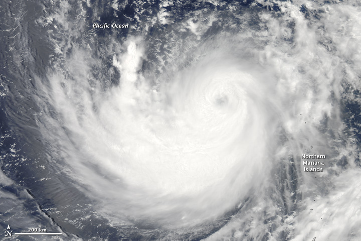
<<In mid-July 2011, the eighth tropical storm of the Pacific storm season rapidly intensified and was officially declared Typhoon Ma-on. Bands of the typhoon sent soaking rain across Guam, the Mariana Islands, and other tropical Pacific locations. The storm appeared to be headed toward Okinawa and then the disaster-ravaged Japanese mainland, forecasts suggested.
The Moderate Resolution Imaging Spectroradiometer (MODIS) on NASA’s Aqua satellite acquired this image on July 15, 2011. At 15:00 Universal Time on July 15, the typhoon was centered approximately 270 nautical miles (500 kilometers) south-southeast of Iwo To, Japan, and moving west at 12.6 miles per hour (20 kilometers per hour, 11 knots). The typhoon packed sustained winds of 132 miles per hour (213 kilometers per hour, or 115 knots), with gusts to 161 miles per hour (259 kilometers per hour, or 140 knots).>>
Typhoon Ma-on
- neufer
- Vacationer at Tralfamadore
- Posts: 18805
- Joined: Mon Jan 21, 2008 1:57 pm
- Location: Alexandria, Virginia
Typhoon Ma-on
Art Neuendorffer
