ESA News - 29 June 2010
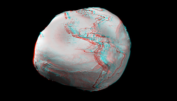
The first global gravity model based on GOCE satellite data has been presented at ESA’s Living Planet Symposium. ESA launched GOCE in March 2009 to map Earth's gravity with unprecedented accuracy and resolution.
The model, based on only two months of data, from November and December 2009, shows the excellent capability of the satellite to map tiny variations in Earth’s gravity.
...
New GOCE models are already yielding a wealth of new information that is useful for many domains of geosciences. GOCE’s final gravity map and geoid will be instrumental in advancing science and applications in a broad range of disciplines, ranging from geodesy, geophysics and surveying to oceanography and sea-level research.