Page 1 of 2
Earth at Night, Global Economics Remote Sensing (05 Oct 08)
Posted: Sun Oct 05, 2008 7:49 am
by jose palacios
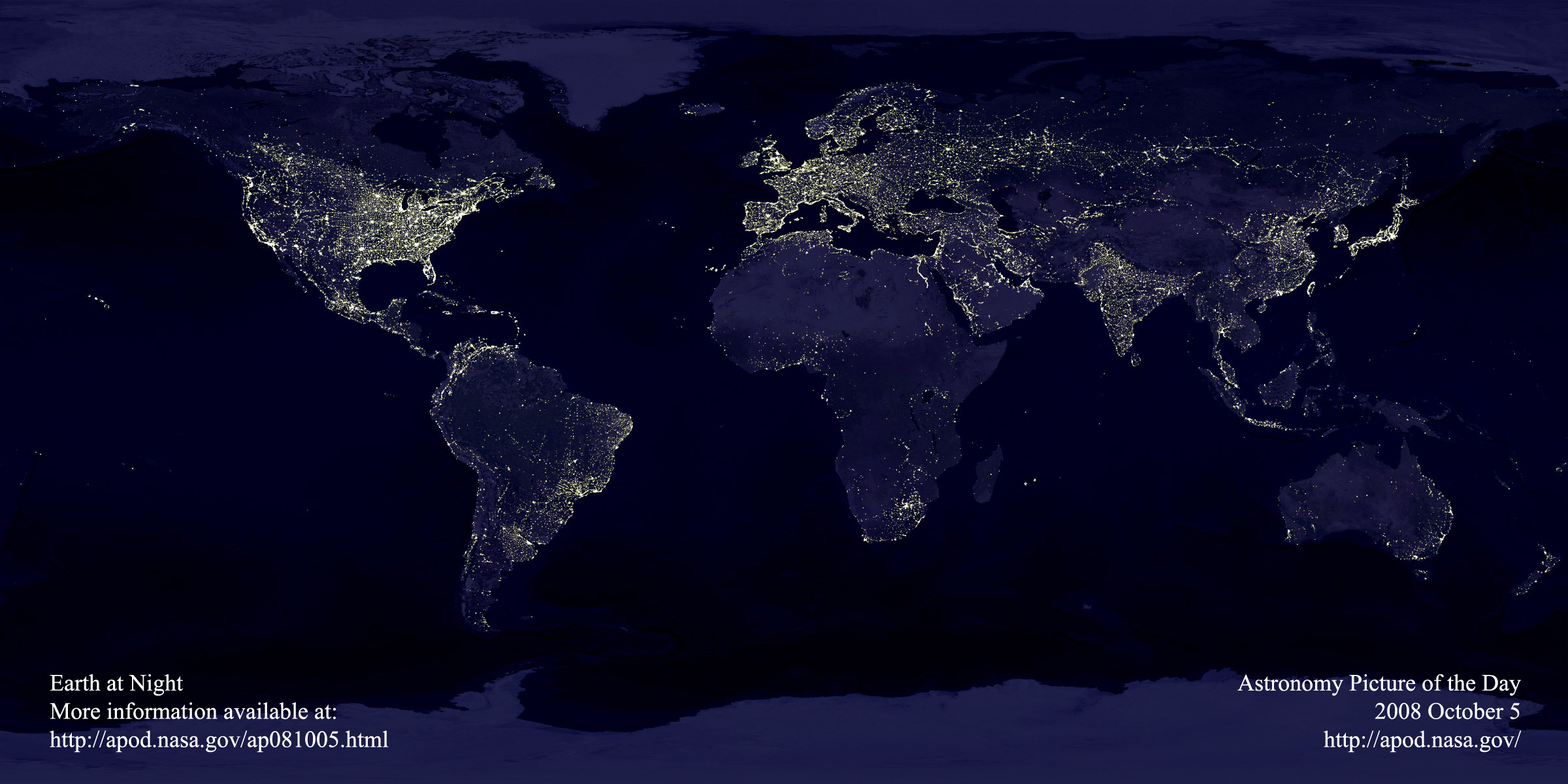
Once again I am impressed by the picture of earth at night shown today in APOD. This is an increasing problem for astronmers, specially for amateur ones and, more importantly a symptom of energy wastefulness. It can be seen as a marker of electricity waste. It would be nice to see whether the current energy saving mesures are able to reduce it. I remembered having seen this picture before. When I looked for the file, I found that the same, exactly the same picture, was shown at the same APOD page about six years before (2002 august 11). Does anybody know wether there is an updated version of it? 6 years is long time enough as to see changes. It would be interesting to know whether it could show some progress in undeveloped countries (even if that means more light emitted to space), and also progress (in the sense of less light wasted) in developed countries.
Best wishes,
Jose
Posted: Sun Oct 05, 2008 8:41 am
by PaulM
You are right, Jose. This is a wonderful, yet extremely outdated, image. 6 years ago, the population of the earth was a little over 6 billion. Today it is approaching the 6.8 billion mark. An updated image would look quite different. While we're waiting for one, you might like to take a look at this:
http://www.opentopia.com/sunlightmaprect.html. With a little patience, you might even be able to make your own earthlights image. Here's one I knocked together while writing this message:
http://i23.photobucket.com/albums/b378/ ... light2.jpg (I removed this image because I've made a better one. See the link further down the thread).
Cheers,
Paul
Link not working
Posted: Sun Oct 05, 2008 9:36 am
by Andy Wade
Re: Link not working
Posted: Sun Oct 05, 2008 9:41 am
by Case
Because of the end-of-sentence dot at the end.
http://www.opentopia.com/sunlightmaprect.html works.
Posted: Sun Oct 05, 2008 12:25 pm
by PaulM
Sorry about that, Andy. Darned dot! Thanks for sorting it out, Case.
I see you're from Yorkshire, Andy. Lovely place; lovely people. I'm from the north east, myself, but I studied in Leeds back in the early 70s, then lived in Headingley for 4 years before leaving the UK to teach at universities in Germany and Scandinavia. I'm living in Spain at the moment, but will return to the UK for a while in January 09.
There's a small village in the Valencian mountains called El Toro. If you walk out of the village on a cloudless night after everyone has gone to bed and the street lights have been switched off, you'll get the most incredible view of the sky. Just thought I'd mention that.
Cheers,
Paul
Visible Politics
Posted: Sun Oct 05, 2008 1:29 pm
by RonDavis
I wondered what was that large island west of Japan, and was saddened to realize that it is South Korea, showing the enormously destructive effect of the government of North Korea. Similarly, the Nile Valley disappears tragically at the Sudanese border. As contrary emphasis, I notice the Trans-Siberian Railway very clearly.
Fascinating though this picture is, I hope APOD is not going to fall into nothing but recycling old pictures.
Re: Visible Politics
Posted: Sun Oct 05, 2008 2:08 pm
by PaulM
RonDavis wrote:Fascinating though this picture is, I hope APOD is not going to fall into nothing but recycling old pictures.
I agree.
Traditions
Posted: Sun Oct 05, 2008 2:41 pm
by Beanbrain
Seeing the Earth at Night every other year since 2000 is one terrific idea. Seeing the same image all four times strips it of any meaning. Sure, this spectacular image has now been exposed to more people, but after 8 years, it's time for an update. (Gimme, gimme, gimme...)
Posted: Sun Oct 05, 2008 4:14 pm
by PaulM
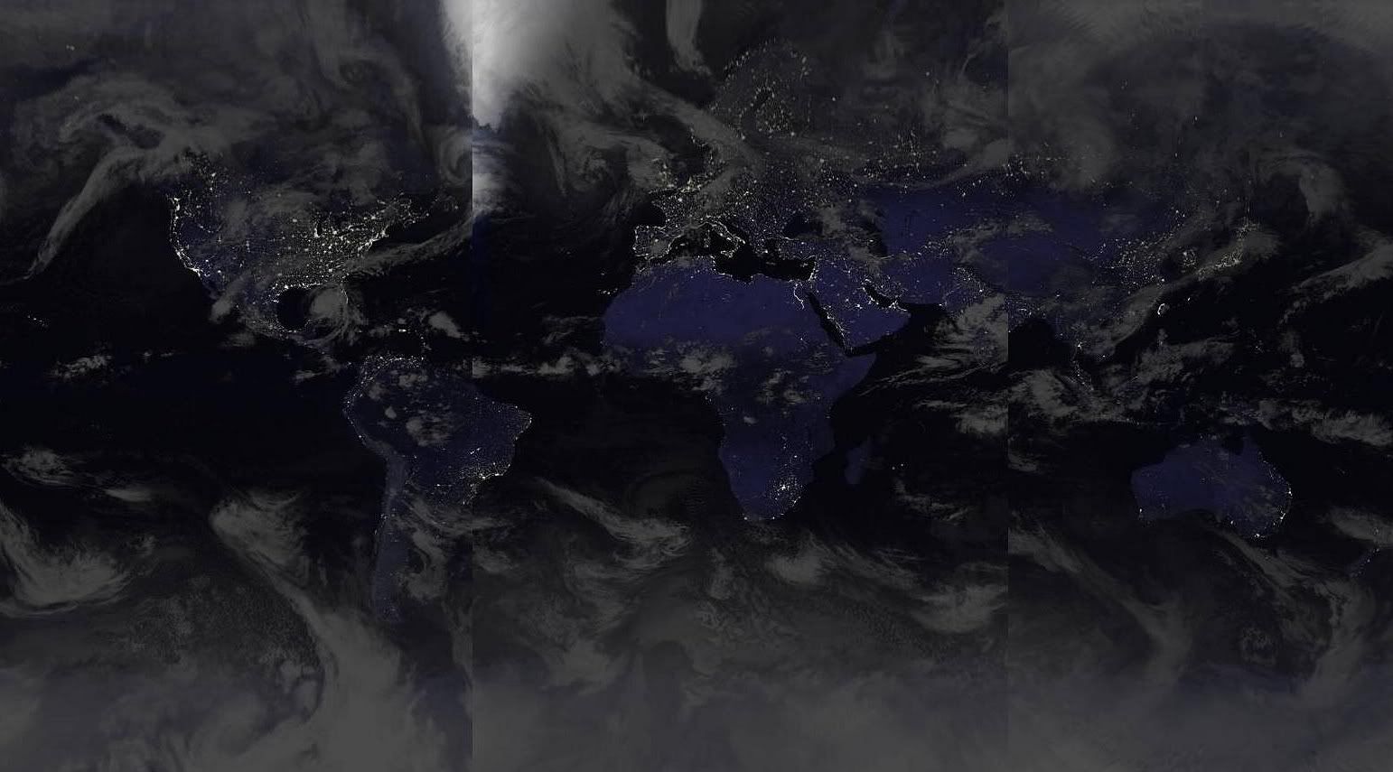
Here's another attempt at creating a new earthlights image. This one's a little larger and almost totally night. I'll add the final dark strip when I get the opportunity to capture it. All sections of the image are from the past couple of weeks. Of course, it will never be perfect because the cloud formations are changing all the time:
http://i23.photobucket.com/albums/b378/ ... ights2.jpg
Cheers,
Paul
earth at night
Posted: Sun Oct 05, 2008 6:53 pm
by jose palacios
Thanks for all the comments. The on-line pictures are great, although resolution and, of course, clouds, make them less informative (and more real, though). I guess some agency is updating the image somewhere.
Cheers,
Jose
Re: Visible Politics
Posted: Sun Oct 05, 2008 8:57 pm
by BMAONE23
RonDavis wrote:I wondered what was that large island west of Japan, and was saddened to realize that it is South Korea, showing the enormously destructive effect of the government of North Korea. Similarly, the Nile Valley disappears tragically at the Sudanese border. As contrary emphasis, I notice the Trans-Siberian Railway very clearly.
Fascinating though this picture is, I hope APOD is not going to fall into nothing but recycling old pictures.
Ron,
I was just wondering what you see in the image that implies the "enormously destructive effect" by North Korea. Is it the total lack of an electric infrastructure???
Re: Visible Politics
Posted: Sun Oct 05, 2008 9:00 pm
by BMAONE23
BMAONE23 wrote:RonDavis wrote:I wondered what was that large island west of Japan, and was saddened to realize that it is South Korea, showing the enormously destructive effect of the government of North Korea. Similarly, the Nile Valley disappears tragically at the Sudanese border. As contrary emphasis, I notice the Trans-Siberian Railway very clearly.
Fascinating though this picture is, I hope APOD is not going to fall into nothing but recycling old pictures.
Ron,
I was just wondering what you see in the image that implies the "enormously destructive effect" by Nort Korea. Is it the total lack of an electric infrastructure???
http://antwrp.gsfc.nasa.gov/apod/ap081005.html
Posted: Sun Oct 05, 2008 10:09 pm
by Tilt
Light Pollution! <ARGH> The bane of my existence.
http://www.darksky.org
Re: Visible Politics
Posted: Mon Oct 06, 2008 2:49 am
by neufer
RonDavis wrote:I wondered what was that large island west of Japan, and was saddened to realize that it is South Korea, showing the enormously destructive effect of the government of North Korea. Similarly, the Nile Valley disappears tragically at the Sudanese border.
One wonders what the Nile Valley would look like without the Aswan Dam:
.........................................................
- http://en.wikipedia.org/wiki/Aswan_Dam
<<The earliest attempt at building a dam in Aswan dates back to the 1000s, when the Iraqi polymath and engineer Ibn al-Haytham (known as Alhazen in the West) was summoned to Egypt by the mercurial Fatimid Caliph, Al-Hakim bi-Amr Allah, to regulate the flooding of the Nile, a task requiring an early attempt at an Aswan Dam. After his field work made him aware of the impracticality of this scheme, and fearing the caliph's anger, he feigned madness. He was kept under house arrest from 1011 until al-Hakim's death in 1021, during which time he wrote his influential Book of Optics.>>
.........................................................
[Perhaps without "crazy" al-Hakim's _Book of Optics_ we wouldn't have APODs.]
-----------------------------------------------------
Adjusting for dams, rail lines, and oil facilities
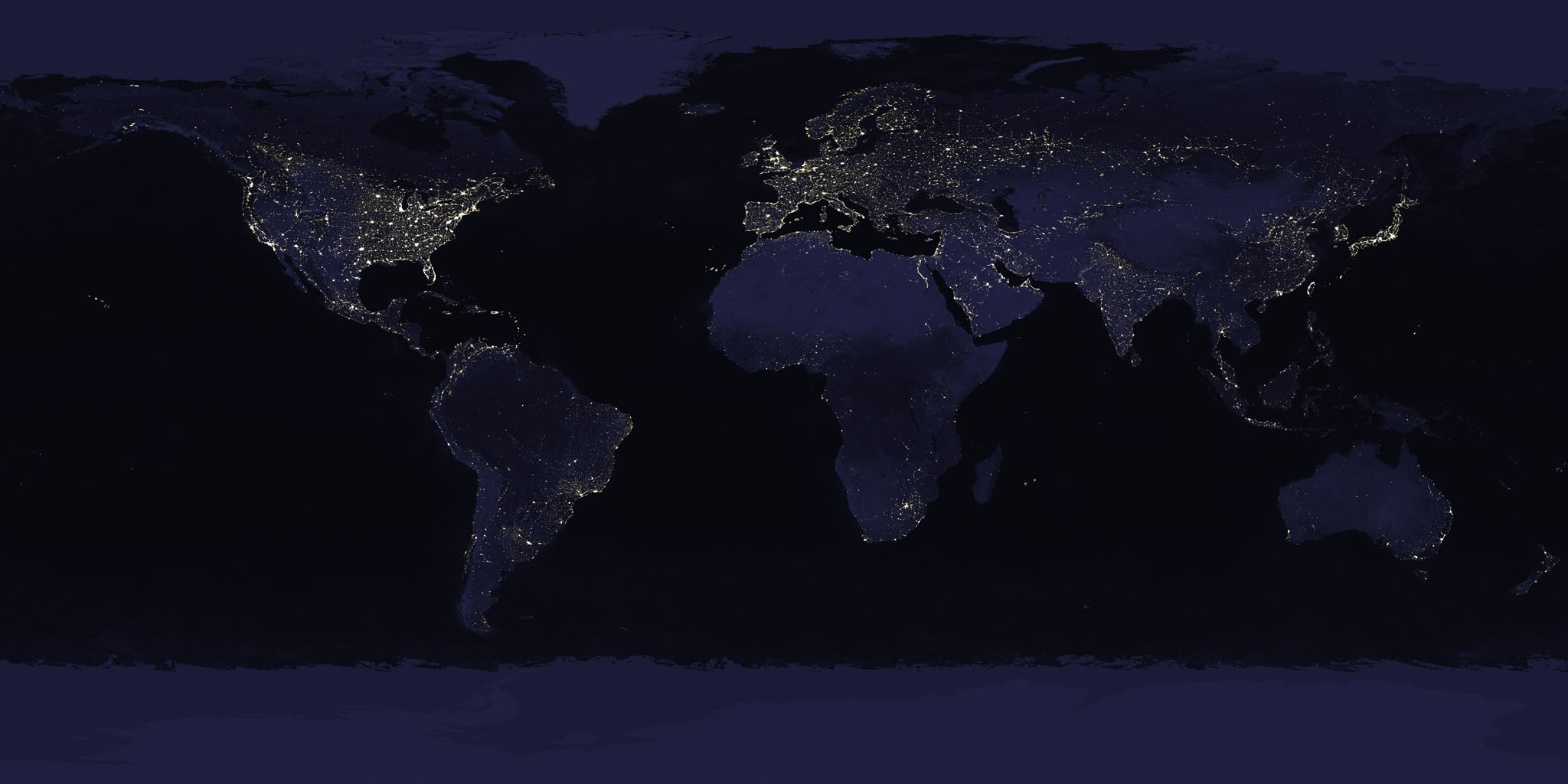
http://apod.nasa.gov/apod/image/0810/ea ... sp_big.jpg
is perhaps a pretty good map of GNP (and/or tourism) per acre...
poor Ethiopia & Somalia don't show up very well; however, Tahiti:


Posted: Mon Oct 06, 2008 3:39 pm
by forty
PaulM wrote:Here's another attempt at creating a new earthlights image. This one's a little larger and almost totally night. I'll add the final dark strip when I get the opportunity to capture it. All sections of the image are from the past couple of weeks. Of course, it will never be perfect because the cloud formations are changing all the time:
http://i23.photobucket.com/albums/b378/ ... ights2.jpg
What makes you think that this is a somewhat actual image?
It's the very normal night.jpg from xplanet, used there since years. Nobody actualizes this pic. The only thing that is actual is the cloud layer. I use this program since years and everyday as my desktop background.
http://xplanet.sourceforge.net/
http://xplanet.sourceforge.net/xplanet- ... /night.jpg
Greater:
http://nguild.org/tiki-download_wiki_at ... p?attId=10
Posted: Mon Oct 06, 2008 4:06 pm
by PaulM
Hi Forty,
I never implied that it was a real image of the earth. Thanks for the info anyway.
Cheers,
Paul
Posted: Mon Oct 06, 2008 4:18 pm
by PaulM
Remote Sensing of Global Economics
Posted: Mon Oct 06, 2008 5:39 pm
by anorlunda
Every time I see the image of earth at night, I'm struck by what it reveals about wealth. The brightness of an area is proportional to the population times the average affluence of the people. In other words, the total weath of the region.
Obviously, the measurements are not perfect. I certainly isn't going to catch the daily fluctuations of the stock market. Nevertheless, consider how many bean counters one would have to hire to come up with an equally inaccurate picture. All in all, this method of remote sensing economics is truly remarkable.
Suppose we were able to capture a similar image of an inhabited alien planet. What inferences would we make?
Posted: Mon Oct 06, 2008 6:51 pm
by forty
PaulM wrote:Hi Forty,
I never implied that it was a real image of the earth. Thanks for the info anyway.
This sounded like this could be an alternative to the outdated APOD pic, maybe I misunderstood you.
Fact is that the one from APOD ist from the same source and same age as the night.jpg of xplanet, all from the DMSP.

Re: Remote Sensing of Global Economics
Posted: Mon Oct 06, 2008 10:05 pm
by neufer
anorlunda wrote:Every time I see the image of earth at night, I'm struck by what it reveals about wealth. The brightness of an area is proportional to the population times the average affluence of the people. In other words, the total wealth of the region.
The total wealth of the natives and the tourists (e.g., Tahiti) per acre (correcting for dams, oil & railroads).
Re: Remote Sensing of Global Economics
Posted: Mon Oct 06, 2008 10:08 pm
by apodman
http://antwrp.gsfc.nasa.gov/apod/ap081005.html
anorlunda wrote:Suppose we were able to capture a similar image of an inhabited alien planet. What inferences would we make?
I would infer that they care as little as we do about light pollution. If they didn't aim their lights uselessly into the sky like we do, we wouldn't be able to see them.
Re: Remote Sensing of Global Economics
Posted: Mon Oct 06, 2008 10:50 pm
by Andy Wade
anorlunda wrote:Every time I see the image of earth at night, I'm struck by what it reveals about wealth. The brightness of an area is proportional to the population times the average affluence of the people. In other words, the total weath of the region.
Obviously, the measurements are not perfect. I certainly isn't going to catch the daily fluctuations of the stock market. Nevertheless, consider how many bean counters one would have to hire to come up with an equally inaccurate picture. All in all, this method of remote sensing economics is truly remarkable.
Suppose we were able to capture a similar image of an inhabited alien planet. What inferences would we make?
My bold.
Good thing too, or after today's shenanigans and the doom and gloom forecasts for the near future most of those lights would be going out very soon. I hope not anyway.
Looking out of the window here all I can see is artificial lights which make for really poor night sky viewing. There's a guy across the garden behind us who leaves a 500 watt security light on all night.

The First Women Barefoot Solar Engineers Of The World
Posted: Tue Oct 07, 2008 1:15 am
by neufer
Re: Visible Politics
Posted: Thu Oct 09, 2008 11:33 pm
by iamlucky13
BMAONE23 wrote:Ron,
I was just wondering what you see in the image that implies the "enormously destructive effect" by North Korea. Is it the total lack of an electric infrastructure???
Precisely. I've read commentary on this exact subject before. Look how distinctly the DMZ is drawn by the lights.
You can explore the economic idea further by find countries with low GDP's (try the
CIA World Factbook) and finding them on the APOD.
There's a few other items that really stood out to me:
- Near the US coasts, cities appear to follow natural features, like the valley between the Cascades and the Rockies. In the midwest, however, they're almost gridded.
- The railways across Siberia are plainly visible.
- The Nile is even more plain...probably the sharpest feature on the map. It's clear why Egypt was an ancient superpower.
- Bermuda looks kind of lonely.
- The Gobi Desert, Sahara, Congo, and Amazon...all very empty.
Posted: Sat Oct 11, 2008 11:45 am
by Fermats Brother
Hi - Newby here !
I accept that we have a problem with light-polluted skys.
However, I'm a little skeptical about this picture, in that I cannot find any mention of exposure time(s). I think this is important in putting this picture into perspective. As presented, I get the impression that I could read my newspaper in my satellite with the lights switched off !!
There are many galaxies we can see in photographs, but which require exposure times of several hours. Maybe this is similar.
Fermats Brother