
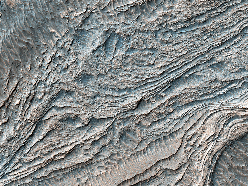
Jennifer Griffes wrote:Clinoforms in Melas Chasma (PSP_008735_1700)
This group of steeply inclined light-toned layers is bounded above and below by unconformities (sudden or irregular changes from one deposit to another) that indicate a “break” where erosion of pre-existing layers was taking place at a higher rate than deposition of new materials.
The layered deposits in Melas Basin may have been deposited during the growth of a delta complex. This depositional sequence likely represents a period where materials were being deposited on the floor of a lake or running river.
This is a stereo pair with PSP_007878_1700.
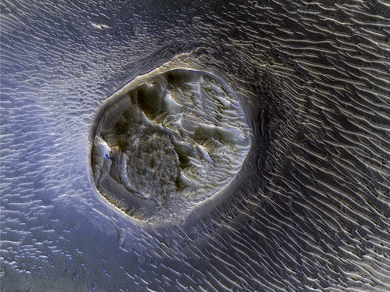
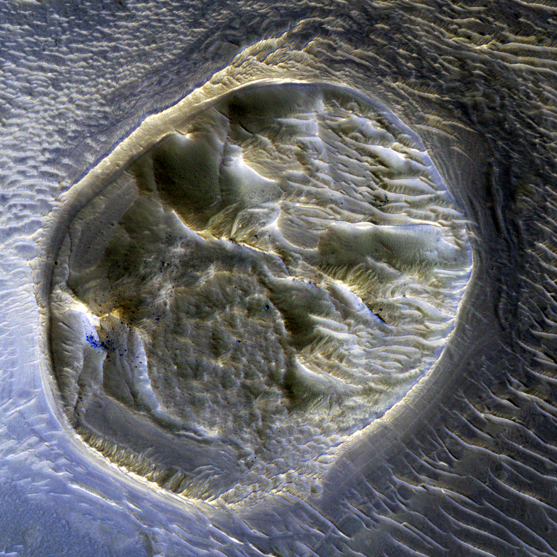
Nicole Baugh wrote:A Mesa in Noctis Labyrinthus (ESP_012744_1725)
This small (0.4 kilometer) mesa is one of several surrounded by sand dunes in Noctis Labyrinthyus, an extensively fractured region on the western end of Valles Marineris.
Heavily eroded, with clusters of boulders and sand dunes on its surface, this layered mesa is probably comprised of sedimentary deposits that are being exhumed as it erodes. The layers themselves are visible as faint bands along the lower left edge of the mesa.
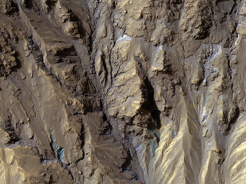
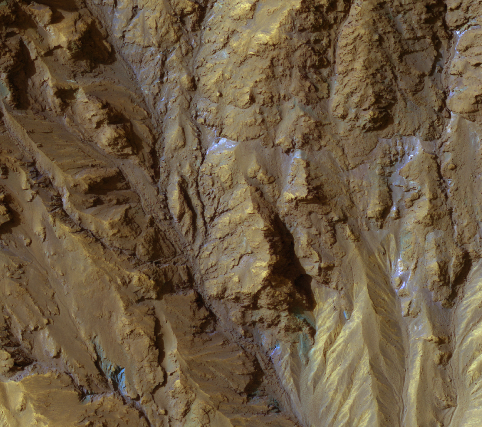
Sarah Mattson wrote:Sources of Gullies in Hale Crater (PSP_005688_1450)
HiRISE color can show mineralogical differences due to the near-infrared filter. The sources of channels on the north rim of Hale Crater show fresh blue, green, purple and light toned exposures under the the overlying reddish dust.
The causes and timing of activity in channels and gullies on Mars remains an active area of research. Geologists infer the timing of different events based on what are called “superposition relationships” between different landforms. Areas like this are a puzzle!
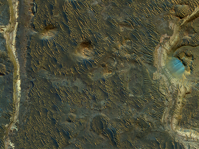
Alfred McEwen wrote:Lakebeds in Holden Crater (ESP_011542_1530)
Holden Crater was once filled by at least *two* different lakes. The sediments deposited in those lakes are relatively light-toned where exposed, as we see in this observation.
Each layer represents a different point in time and perhaps a changing environment for Martian life, if it existed. The elongated ridges with sharp crests are sand dunes.
NB: North is to the left in the cutout image.
Credit: NASA/JPL-Caltech/University of Arizona
<< Previous HiRISE Update