
The team found that the September ozone hole has shrunk by more than 4 million square kilometers — about half the area of the contiguous United States — since 2000, when ozone depletion was at its peak.
Weather!
-
neufer

- Vacationer at Tralfamadore
- Posts: 18805
- Joined: Mon Jan 21, 2008 1:57 pm
- Location: Alexandria, Virginia
Re: Weather!
Art Neuendorffer
-
neufer
- Vacationer at Tralfamadore
- Posts: 18805
- Joined: Mon Jan 21, 2008 1:57 pm
- Location: Alexandria, Virginia
Super Typhoon Nepartak, to Hit Taiwan Jul 07, 2016
Click to play embedded YouTube video.
Click to play embedded YouTube video.
Art Neuendorffer
-
neufer
- Vacationer at Tralfamadore
- Posts: 18805
- Joined: Mon Jan 21, 2008 1:57 pm
- Location: Alexandria, Virginia
Re: Weather!
Click to play embedded YouTube video.
Published on Jul 7, 2016
Raw footage of super typhoon Nepartak battering the city of Taitung in SE Taiwan. For licensing please email James (at) EarthUncut (dot) TV No unauthorized media use
Art Neuendorffer
Re: Weather!

The Malmö festival. Photo: Stefan Stenudd.
Tomorrow temperatures are going to plunge, and we will have more and more rain.
Ann
Color Commentator

Re: Weather!
Would you mind barreling some of it and shipping it to me in California?Ann wrote:Lovely day today. Sunny, warm, 21C. We haven't had many of those days in August. The Malmö Festival is in progress, so people are filling the downtown streets and squares, mingling about, buying snacks, listening to music and watching performances. The picture at left is from 2009, and today was sunnier.The Malmö festival. Photo: Stefan Stenudd.
Tomorrow temperatures are going to plunge, and we will have more and more rain.
Ann
We could use some of those Martian Canals
Re: Weather!
I wasn't really listening to what you were saying here, BMAONE, but now I think I understand that you were talking about the forest fires of California, plus perhaps a general possibly state-wide drought.BMAONE23 wrote:Would you mind barreling some of it and shipping it to me in California?Ann wrote:Lovely day today. Sunny, warm, 21C. We haven't had many of those days in August. The Malmö Festival is in progress, so people are filling the downtown streets and squares, mingling about, buying snacks, listening to music and watching performances. The picture at left is from 2009, and today was sunnier.The Malmö festival. Photo: Stefan Stenudd.
Tomorrow temperatures are going to plunge, and we will have more and more rain.
Ann
We could use some of those Martian Canals
Is that correct? How are things where you live?
Ann
Last edited by Ann on Fri Aug 19, 2016 5:44 am, edited 1 time in total.
Color Commentator
Re: Weather!
Very dry after several years of extended drought. Though Temp wise, my particular neck of the woods (Sonoma County) is pretty much normal for Summer. We had a Big Fire in Lake County last year (September) that burned much of Middletown and another that burned North of Clearlake at the same time.
Now we have a fire that is burning in Lower Lake, the Clayton Fire, in the exact area between both other fires. News yesterday was that they arrested an arsonist and charged his with starting numerous recent fires including the Clayton Fire which has burned almost 4000 acres and destroyed over 260 homes and businesses decimating much of downtown Lower Lake. Dealing with Drought and Fire potential is bad enough without needing to deal with a fire bug burning down the house.
Now we have a fire that is burning in Lower Lake, the Clayton Fire, in the exact area between both other fires. News yesterday was that they arrested an arsonist and charged his with starting numerous recent fires including the Clayton Fire which has burned almost 4000 acres and destroyed over 260 homes and businesses decimating much of downtown Lower Lake. Dealing with Drought and Fire potential is bad enough without needing to deal with a fire bug burning down the house.
Re: Weather!
That's really bad. Arsonists using a bad situation to make it orders of magnitude worse are quite terrible.
Ann
Ann
Color Commentator
-
rstevenson

- Quis custodiet ipsos custodes?
- Posts: 2705
- Joined: Fri Mar 28, 2008 1:24 pm
- Location: Halifax, NS, Canada
Re: Weather!
We've also just had a few wild fires here in Nova Scotia, ordinarilly one of the damper parts of Canada. But this year we're sharing in the dry heat that's been sweeping over much of North America. I blame Donald Trump. He certainly creates more than his fair share of hot air. I'm looking forward to November, when the temperatures drop and the hot air (mostly) ends.
Rob
Rob
Thunderclouds over Malmö
Undulatus Asperatus over Malmö. Photo: Anders Nilsson.
Photo: Anders Nilsson
The dramatic clouds at left, Undulatus Asperatus, were loomnig over my hometown of Malmö this morning. A thunderstorm with a lot of rain took about two hours to pass by. After that it cleared up and got quite warm (well, warm for Sweden in late August, about 22C).
Now the sky has darkened again, and I can hear thunder.
Ann
Color Commentator
-
Fred the Cat

- Theoretic Apothekitty
- Posts: 975
- Joined: Mon Feb 22, 2016 4:09 pm
- AKA: Ron
- Location: Eagle, Idaho
Re: Weather!
Freddy's Felicity "Only ascertain as a cat box survivor"
-
Fred the Cat
- Theoretic Apothekitty
- Posts: 975
- Joined: Mon Feb 22, 2016 4:09 pm
- AKA: Ron
- Location: Eagle, Idaho
Re: Weather!
I hate to post this but it makes me wonder if the storm Ann was describing could have been responsible.
http://www.nytimes.com/2016/08/30/world ... share&_r=0
http://www.nytimes.com/2016/08/30/world ... share&_r=0
Freddy's Felicity "Only ascertain as a cat box survivor"
-
Chris Peterson

- Abominable Snowman
- Posts: 18594
- Joined: Wed Jan 31, 2007 11:13 pm
- Location: Guffey, Colorado, USA
- Contact:
Re: Weather!
Not the same storm. This happened 600 km away from Malmö. If the timing is right, it might be part of the same broad storm system or weather pattern, but lightning like that occurs in rather small cells. Certainly, the clouds that Ann saw weren't producing lightning that was striking that far away. Indeed, asperitas clouds like those shown don't typically produce storms or lightning at all.Fred the Cat wrote:I hate to post this but it makes me wonder if the storm Ann was describing could have been responsible.
http://www.nytimes.com/2016/08/30/world ... share&_r=0 :(
Chris
*****************************************
Chris L Peterson
Cloudbait Observatory
https://www.cloudbait.com
*****************************************
Chris L Peterson
Cloudbait Observatory
https://www.cloudbait.com
Re: Weather!
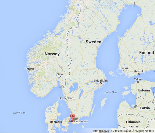
Check out this map. Malmö is under the the red upside down "teardrop" with an A inside. (Copenhagen is on the other side of the Strait of Öresund, in Denmark.) Gothenburg, or Göteborg to us Swedes, is located north of Malmö on the west coast of Sweden. Norway is further north and west of Malmö and Gothenburg.
Anyway. The storm that hit Malmö moved north and admittedly east too, but it was more severe along the west coast of Sweden than it was inland. The east coast of Sweden got some rain, but not much more than that.
I too read about the dead reindeer in Norway, and I just took it for granted that they died because of something caused by the same storm system that hit Malmö. In Sweden, the death of the reindeer has certainly been treated as a "weather event" that was related to what happened in Malmö and in the southwest of Sweden.
And if Asperatus clouds don't typically produce thunder and lightning, the ones over Malmö certainly did. Or maybe the thunder and lightning was produced by other clouds that followed behind.
Ann
Color Commentator
Re: Weather!
Two years ago, on August 31, 2014, Malmö was flooded. The picture at left is from Malmö. Passengers on a bus caught in the flood leave the bus on a ladder. Malmö is a quite flat city on the coast of Öresund, and much of the city was actually flooded. In the condominium house where I live, we had water in the basement, and extensive repairs have been made. But many people were hit much worse than us. (No one was killed or severely hurt, though.)
Exactly two years later, we had the kind of temperature contrasts in Europe that you can see in the image at right. I think it is these temperature contrasts that cause the extreme weather conditions that my city has experienced a few times in later years. I think it has to do with global warming, because we certainly didn't have any flooding in Malmö between 1964 and, say, 2010 or so.
This picture is from a winter storm in December 2012. The central, downtown part of Malmö so nearly got flooded.
Ann
Color Commentator
Re: Weather!
I'm not looking forward to October, November and December. Above all, I'm not looking forward to January and February!
Ann
Color Commentator
-
Chris Peterson
- Abominable Snowman
- Posts: 18594
- Joined: Wed Jan 31, 2007 11:13 pm
- Location: Guffey, Colorado, USA
- Contact:
Re: Weather!
That's nearly half the year you don't look forward to. Sad and horrible. Maybe you should move.Ann wrote:After a moderately cool July and August, September has been really warm. It's been quite lovely, actually.
I'm not looking forward to October, November and December. Above all, I'm not looking forward to January and February!
Chris
*****************************************
Chris L Peterson
Cloudbait Observatory
https://www.cloudbait.com
*****************************************
Chris L Peterson
Cloudbait Observatory
https://www.cloudbait.com
Re: Weather!
Yeah, well... the weather and the climate is not much better anywhere else in Sweden. So, should I emigrate? Can't say I want to do that.Chris Peterson wrote:That's nearly half the year you don't look forward to. Sad and horrible. Maybe you should move.Ann wrote:After a moderately cool July and August, September has been really warm. It's been quite lovely, actually.
I'm not looking forward to October, November and December. Above all, I'm not looking forward to January and February!
Ann
Color Commentator
Re: Weather!
Tennis player Arthur Ashe, the first black American to win Wimbledon, published a diary he had written as he traveled around the world on the international tennis tour in the 1970s. In that book, he wrote about visiting Stockholm in December to play Stockholm Open. I can't find Ashe's book any more, but I remember what he wrote about Stockholm in December:
It gets dark here around 3 p.m. It's very depressing, and people here conquer it by drinking heavily.
I really dislike the darkness of winter myself, but to me, the terrible gray icy cold of January and February is worse.
Ann
It gets dark here around 3 p.m. It's very depressing, and people here conquer it by drinking heavily.
I really dislike the darkness of winter myself, but to me, the terrible gray icy cold of January and February is worse.
Ann
Last edited by Ann on Tue Sep 13, 2016 1:39 am, edited 1 time in total.
Color Commentator

Re: Weather!
It is practically impossible to relate a handful of extreme weather events in a single location, to global warming. One must look at many locations over a sufficient period of time and analyze the data against older records. The probability of extreme rainfall/flood events like these in any one location is typically measured in long time scales like 1 in 10 years, 1 in 50 years, 1 in 100 years, etc. Of course, extreme rainfall events occur somewhere on the surface of Earth at all times. And at any single location, it is not uncommon to observe clusters of extreme rainfall events in a relatively short period. Such is probability.Ann wrote:Two years ago, on August 31, 2014, Malmö was flooded. The picture at left is from Malmö. Passengers on a bus caught in the flood leave the bus on a ladder. Malmö is a quite flat city on the coast of Öresund, and much of the city was actually flooded. In the condominium house where I live, we had water in the basement, and extensive repairs have been made. But many people were hit much worse than us. (No one was killed or severely hurt, though.)
Exactly two years later, we had the kind of temperature contrasts in Europe that you can see in the image at right. I think it is these temperature contrasts that cause the extreme weather conditions that my city has experienced a few times in later years. I think it has to do with global warming, because we certainly didn't have any flooding in Malmö between 1964 and, say, 2010 or so.
This picture is from a winter storm in December 2012. The central, downtown part of Malmö so nearly got flooded.
Ann
However, it is quite certain that flat coastal cities and towns can expect an increased probability of flooding in the coming centuries, if the sea continues to rise to predicted levels. Extreme rainfall events concurrent with higher high tides and/or storm surges, pose an expensive problem for such populations.
In general terms, increased urbanization also increases the risk of flooding, unless the urbanization is designed and built well (and typically at extra expense), to account for the increase in runoff from paved surfaces.
Global warming is quite likely to change average monthly precipitation in locations all over the world. It will likely also change the probabilities of average rainfall intensities within individual storm events, which is the factor of primary importance to those interested in flood mitigation. But how much these values change (up or down) due to global warming, is not at all well understood at this point in time.
Re: Weather!

Västra hamnen, Malmö.
Photo: Daniaparken, http://www.panoramio.com/photo/26771664
Photo: Daniaparken, http://www.panoramio.com/photo/26771664
Jumping into the Strait of Öresund.
Photo: Johan Nilsson/TT
Photo: Johan Nilsson/TT
Yesterday was incredible. I got home from work at five and decided to cycle around in town. The picture at right is from a few days ago, and shows a boy jumping into the water with the Öresund Bridge on the horizon. The picture at left shows Västra hamnen (West harbour), the new trendy residential/recreational part of Malmö. That picture is from 2009, but it looked almost just like this yesterday - and then I didn't arrive there until after six, and the sun was setting in an hour. But people were still in their swimsuits, sunning themselves, swimming, diving, boating, sailing, canoing, rollerskating, hoverboarding, cycling - I saw two girls on a tandem bicycle - having picnics, barbecuing, sitting at outdoor cafés nearby and acting as if they were squeezing every last bit of summer out of this incredible mid-September day.
Ann
Color Commentator
Re: Weather!

Scaniabadet, Malmö, September 13, 2016.
Photo: Johan Nilsson/TT
Photo: Johan Nilsson/TT
Ann
Color Commentator
-
neufer
- Vacationer at Tralfamadore
- Posts: 18805
- Joined: Mon Jan 21, 2008 1:57 pm
- Location: Alexandria, Virginia
Re: Weather!
https://www.wunderground.com/blog/JeffMasters/comment.html?entrynum=3464 wrote:
Hurricane Matthew Reorganizing Over The Bahamas; Major Shift in Long-Range Track
By: Jeff Masters , 3:40 PM GMT on October 05, 2016
<<Thanks to my advancing years and a low-stress lifestyle that features daily meditation, there’s not much that can move me to profanity—except the occasional low-skill driver who endangers my life on the road. But this morning while looking at the latest weather model runs, multiple very bad words escaped my lips. I’ve been a meteorologist for 35 years, and am not easily startled by a fresh set of model results: situations in 2005 and 1992 are the only ones that come to mind. However, this morning’s depiction by our top models—the GFS, European, and UKMET—of Matthew missing getting picked up by the trough to its north this weekend and looping back to potentially punish The Bahamas and Florida next week was worthy of profuse profanity. While a loop back towards Florida and The Bahamas next week is not yet a sure thing, the increasing trend of our top models in that direction is a strong indication that Matthew will be around for a very long time. Long-range forecasts of wind shear are not very reliable, but this morning’s wind shear forecast from the 00Z run of the European model does show a low to moderate shear environment over the Bahamas and waters surrounding South Florida late next week, potentially supportive of a hurricane--if Matthew survives the high wind shear of 50+ knots expected to affect the storm early next week. The bottom line is that it currently appears that Matthew will not recurve out to sea early next week, and The Bahamas and Florida may have to deal with the storm again next week.>>
Art Neuendorffer
-
geckzilla

- Ocular Digitator
- Posts: 9180
- Joined: Wed Sep 12, 2007 12:42 pm
- Location: Modesto, CA
- Contact:
Re: Weather!
Just call me "geck" because "zilla" is like a last name.
-
neufer
- Vacationer at Tralfamadore
- Posts: 18805
- Joined: Mon Jan 21, 2008 1:57 pm
- Location: Alexandria, Virginia
Re: Weather!
https://en.wikipedia.org/wiki/Vehicle_Assembly_Building wrote: <<The Vehicle (originally Vertical) Assembly Building, or VAB, at NASA's Kennedy Space Center (KSC) is a [526 feet tall, 716 feet long & 518 feet wide] building designed to assemble large space vehicles, such as the massive Saturn V and the Space Shuttle. Future Space Launch System (SLS) will also be assembled there. The most extensive exterior hurricane damage occurred to VAB during the storm season of 2004, when [a Category 1-2] Hurricane Frances blew off 850 14 × 6 foot aluminum panels from the building, resulting in about 40,000 square feet of new openings in the sides. Twenty five additional panels were blown off the east side by the winds from Hurricane Jeanne just three weeks later. The total damage to space and military facilities around Cape Canaveral, Florida was reported at about $100 million. Damage caused by these hurricanes was still visible in 2007. Some of these panels are "punch-outs", designed to detach from the VAB when a large pressure differential is created on the outside vs. the inside. This allows for equalization, and helps protect the structural integrity of the building during rapid changes in pressure such as in tropical cyclones.>>

Art Neuendorffer