HiRISE Science Team wrote:Beautiful Layers in the Central Uplift of Mazamba Crater (ESP_033248_1520) (HiClip)
This is only one of four impact craters known that possesses intact layers exposed in the central uplift.
Scientists believe this layered material originates from kilometers beneath the present surface and is raised up during the formation of the crater itself. These craters give us a window into these deep layers, which would otherwise remain hidden.
This is a stereo pair with PSP_007100_1520.
HiRISE Science Team wrote:Enigmatic Channels on the Floor of Mangala Valles (ESP_033264_1640) (HiClip)
This particular area, called Mangala Valles and located near the Tharsis region, may be an example of the action of liquid water in the ancient Martian past.
It's possible that the wide and short channels visible here may have formed by the motion of groundwater, similar to way channels like these form on Earth.
This is a stereo pair with ESP_033053_1640.
HiRISE Science Team wrote:Martian Thunderbird (ESP_033297_1745) (HiClip)
This non-circular pit is due to a low angle impact from an asteroid or comet. The raised plateau west of the crater was where most of the impact debris landed.
This debris protected the material underneath, but else where this material was slowly removed by the wind and the debris-covered area was left behind as this high-standing and interestingly-shaped plateau.
(Note: the wallpaper images have been rotated 90 degrees counterclockwise for better effect.)
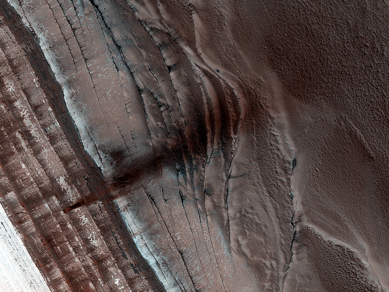
Candy Hansen wrote:Spring Slide (ESP_033433_2650) (HiClip)
The North Polar region of Mars is capped with layers of water ice and dust, called the "polar layered deposits." This permanent polar cap is covered in the winter with a layer of seasonal carbon dioxide ice.
When the sun rises in the spring, the steep edges of the polar layered deposits are the first to warm up. The dry ice sublimes (going directly from a solid to a gas) and destabilizes loose chunks perched on the steep cliff. Material from the weaker layers gets dislodged and cascades down the steep slope.
Here, we can see a dark streak marking the path of that loose material, approximately 1 kilometer wide. HiRISE images often show avalanches in progress in the springtime along the edge of the polar layered deposits in this area.
Credit: NASA/JPL/University of Arizona
<< Previous HiRISE Update


