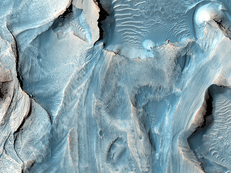
HIRISE Science Team wrote:Possible Cyclic Bedding within a Crater in Arabia Terra (ESP_018714_1890) (HiClip)
This observation covers an outcrop of possible cyclic bedding within a crater in Arabia Terra.
"Cyclic bedding" refers to a pattern of layering caused by repeated fluctuations in the amount of available sediment that creates new rock layers. These fluctuations are caused by long-term changes in the region's climate, with periods on the order of millions, or possibly hundreds of millions of years. It's possible that even the wobble of the planet might be a contributing factor to cyclic bedding.
An image at HiRISE resolution can help evaluate the cyclicity of the beds, as well as test possible regional stratigraphic correlations, and perhaps, indications of a wetter past environment.
This is a stereo pair with ESP_019347_1890.
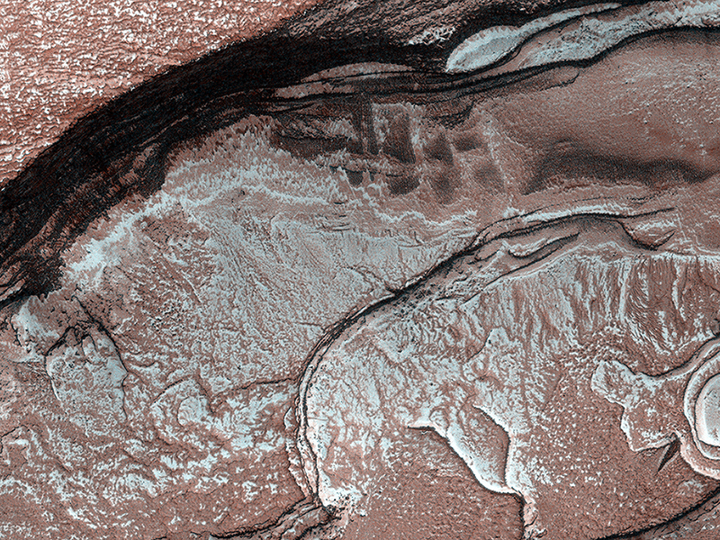
Patrick Russell wrote:Polygonal Surface Patterns at the South Pole (ESP_032487_0895) (HiClip)
Like Earth, Mars has concentrations of water ice at both poles. Because Mars is so much colder, however, the seasonal ice that gets deposited at high latitudes in the winter and is removed in the spring (generally analogous to winter-time snow on Earth) is actually carbon-dioxide ice. Around the South Pole there are areas of this carbon dioxide ice that do not disappear every spring, but rather survive winter after winter. This persistent carbon-dioxide ice is called the "South Polar residual cap."
The white portions of this observation are part of that residual ice cap, and the sunlight is coming from roughly the bottom of this non-map projected image. It is made of solid, frozen carbon dioxide and is very bright relative to the background. This is despite the background terrain having a very high water-ice content, which is darkened by very fine rocky particles, or dust.
Very interesting and picturesque in this scene are the different scales of polygons present in each terrain. The relatively medium-toned lines in the dark terrain divide it into polygons that are up to approximately 10 to 15 meters (30 to 45 feet) wide. Typically, temperature changes of the ground over the seasons cause it to expand and contract, forming cracks and troughs between sections of ground that may partially fill with frost, forming the polygonal pattern viewed from above.
The polygons in the bright carbon dioxide terrain are different. First, they are much larger, up to 20 to 40 meters (60 to125 feet) wide. Second, they are (in most cases) traced out by thin ridges rather than narrow troughs. In rare cases there appears to be a trough where a ridge might be expected, attesting to the complicated patterns that develop in a type of ice that doesn't occur naturally on Earth (meaning, solid carbon dioxide) under conditions that are greatly different from our planet: very cold and very low pressure.
Alfred McEwen wrote:Diffuse Winter Lighting of the Chasma Boreale Scarp (ESP_032559_2645) (HiClip)
Sunlight was just starting to reach the high Northern latitudes in late winter when HiRISE captured this image of part of the steep scarps around portions of the North Polar layered deposits.
The sunlight is highly diffused by atmospheric scattering, with the sun less than 0.5 degrees above the horizon. This diffuse light gives the image a unique appearance, almost like a painting. The surface is entirely covered by carbon dioxide frost mixed with dust.
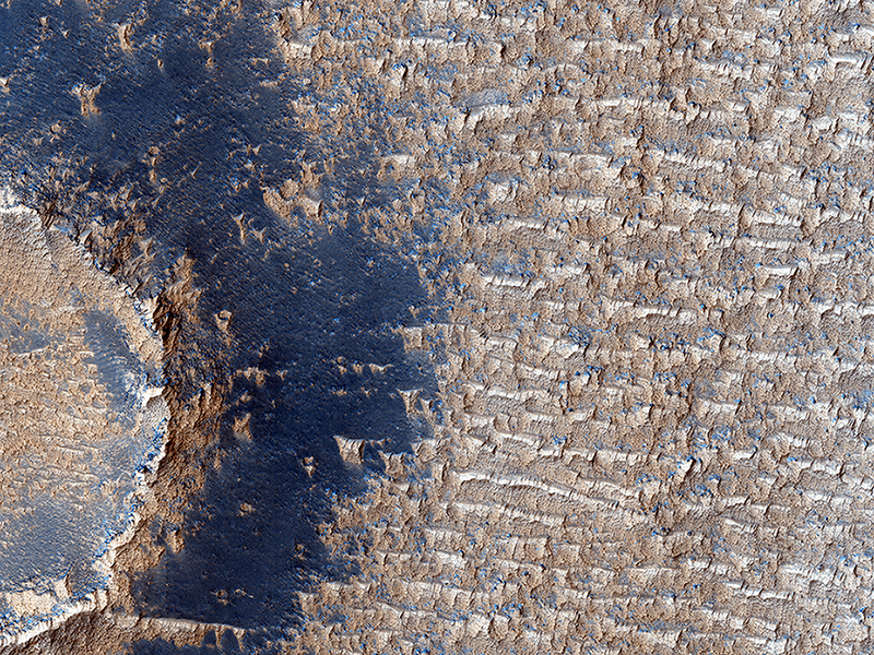
Paul Geissler wrote:Bright Dunes in Syria Planum (ESP_032735_1680) (HiClip)
This image shows curious bright deposits in Syria Planum, a high elevation region near the summit of the Tharsis rise.
Syria Planum has a history of surface changes documented in telescopic and low resolution orbital observations since the Viking era. The surface changes result from the relentless deposition and removal of bright dust, as the dust is transported by winds blowing from north to south across the rocky dark surface.
Isolated patches where thick dust deposits have accumulated can be identified in THEMIS night-time infrared observations. The dust deposits are cooler (darker) than the rocky surface both in daytime and at night. Our HiRISE image was centered on one of these cold spots to observe the interaction of the dust deposits with local topography.
Examining the image shows that the dust here has accumulated into linear arrays of broken ridges spaced about 50 meters apart, and extending from tens to hundreds of meters in length. Dust deposits are visible along the rim of the impact crater but much of the crater's ejecta deposits are strangely dust free.
At full resolution, the ridges appear to have a morphology that is clearly distinct from sand dunes and bright transverse aeolian ridges common elsewhere on Mars. Their steep faces are on the upwind side (in the present day wind regime), opposite to the sand dunes. The ridge crests are crenulated, suggesting that the deposits are currently being eroded by the wind. Fine layering is visible in the deposits, possibly indicating an alternation of dust and sand deposition.
Deposits such as these hint that while modern Mars is relatively benign, the surface of the planet was battered by much more ferocious winds in the recent past, perhaps during periods of high obliquity.
Credit: NASA/JPL/University of Arizona
<< Previous HiRISE Update


