Nicole Baugh wrote:Which Crater Came First? (ESP_020190_1690)
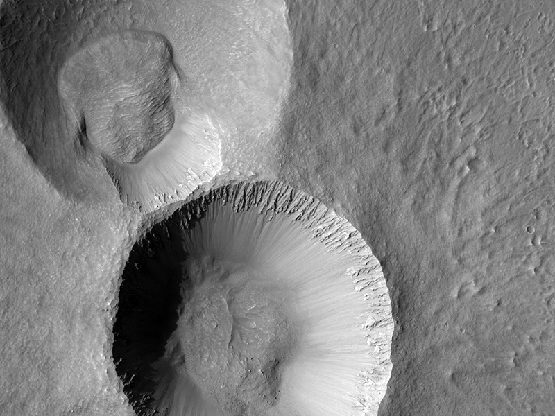
This image shows two craters, both approximately the same diameter (not quite 3 kilometers, or about 1.8 miles), but quite different in appearance otherwise.
The slightly smaller crater to the south seems to have a sharper rim and steeper sides than its partner to the north, which also appears to contain more small craters inside it and along its rim. The interior of the northern crater, in particular its south-facing wall, appears to have a similar texture to the ejecta around the southern crater. This is the second image in a stereo pair (the first is ESP_019346_1690), so we have an anaglyph of these craters.
Although it would require a digital terrain model and more analysis to be certain, in the anaglyph it appears that the southern crater has a higher rim and a deeper center than the northern crater. All these signs point to the northern crater being quite a bit older than the southern crater, rather than the two craters forming in the same impact event. For an example of two craters that might have formed at the same time (see ESP_020894_1395).
Compare the similarity of those two craters with the disparate appearance of the ones in this image.
This is a stereo pair with ESP_019346_1690.
HiRISE Science Team wrote:Sinuous Ridges in Aeolis Planum (ESP_026462_1740)
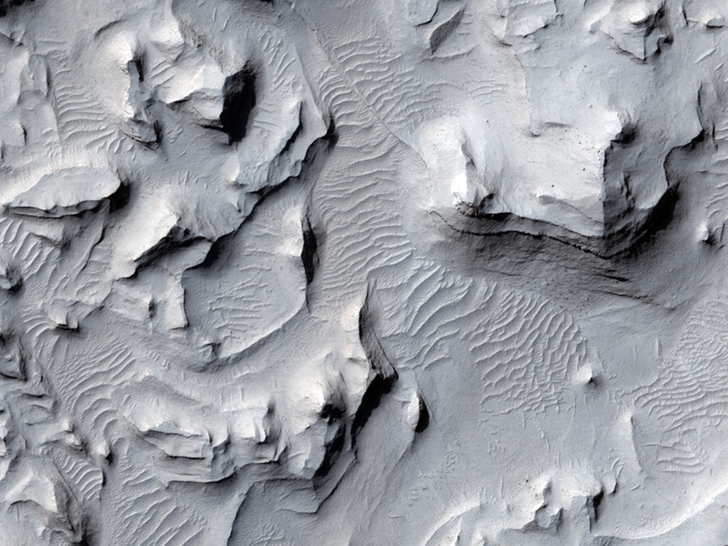
In this image, we see several very sinuous ridges, some very eroded, and others still very well defined.
The eroded ridges are located in a trough, while the well-preserved ridges are at higher elevation. The image allows scientists to characterize the morphology and the local texture of both type of ridges and determine whether those where part of the same network or where formed at two different stratigraphic levels, during different fluvial episodes.
This is a stereo pair with ESP_026818_1740.
Ken Herkenhoff wrote:Wavy-Looking Layers in the North Polar Layered Deposits (ESP_027058_2625)
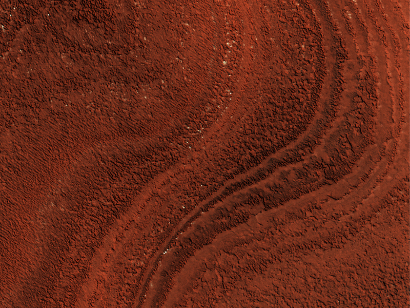
These layers near the North Pole of Mars probably record global climate changes, similar to ice ages on Earth.
They appear wavy here either because flat-lying layers have been eroded into shallow valleys and ridges, or because the layers are not horizontal. Some of these layers are truncated, or appear to pinch out against other layers, evidence of a period of erosion followed by continued deposition of new layers.
The orientations of both the wavy-looking layers and the "unconformity" or erosional surface will be determined once this image and its stereo pair have been used to measure the surface topography.
This is a stereo pair with ESP_026662_2625.
Cathy Weitz wrote:Bright Material along the Floor of a Trough in Noctis Labyrinthus (ESP_027236_1680)
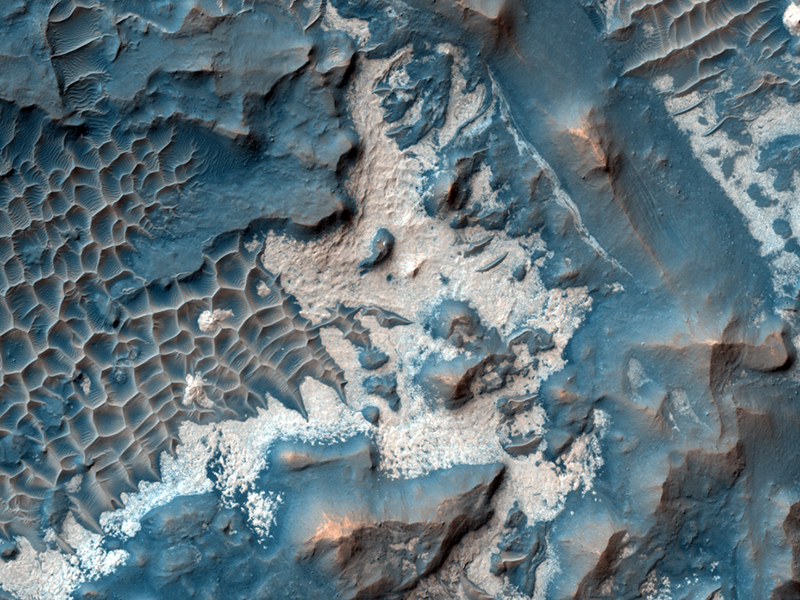
Many of the troughs (or, rounded depressions) of Noctis Labyrinthus contain bright, sometimes layered, materials. Noctis Labyrinthus is located on the far western end of the large canyon system Valles Marineris. To the west lie the volcanoes of Tharsis.
This HiRISE image shows an example of the bright material commonly found along the floors of some of the Noctis troughs. Spectral data from the CRISM instrument, also onboard the MRO spacecraft, indicate the bright material is hydrated (i.e., contains water). The hydrated material may have formed when water upwelled into the low-lying depression or when ice within the trough melted due to heating from volcanic activity.
An earlier image taken of this same location will now be combined with this new image to produce a stereo anaglyph. The stereo should allow scientists to understand the relationship between the bright material and the darker rocks that make up the trough floor.
This is a stereo pair with ESP_017399_1680.
Credit: NASA/JPL/University of Arizona
<< Previous HiRISE Update


