Alfred McEwen wrote:Uplifted Jumble of Ancient Bedrock (ESP_025296_1535)
Impact craters larger than a certain size have complex forms, including central peaks or other structures that result from structural uplift of the target material. This provides a mechanism for exposing deep, ancient bedrock.
The enhanced-color subimage shows a great variety of colors and textures in the bedrock, where it is exposed from beneath a dark fine-grained mantle. The mantle is sometimes modified by the wind into dunes.
The bedrock here includes massive, layered, and broken-up (brecciated) areas. This crater is located in the volcanic plains between Argyre Planitia and Valles Marineris.
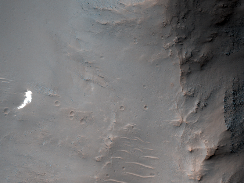
Alfred McEwen wrote:Search for Soviet Mars 6 Lander (ESP_025387_1555)
The Soviet Mars 6 lander arrived at Mars on 12 March 1974. The descent module entered the atmosphere and the parachute opened at 09:08:32 UT--the craft was collecting and returning data. Contact with the descent module was lost at 09:11:05 UT, about when expected to encounter the surface.
Because we know that the parachute opened and have some idea where it was headed, we have a chance of locating the hardware on the surface with HiRISE. In fact, an anomalous small bright patch was seen by MRO's Context Camera (CTX) team, which a CTX team member then suggested as a target for HiRISE.
The bright parachutes were the easiest thing to spot on the ground at 5 of the 6 past successful landing sites. In this subimage we see the bright spot at full HiRISE resolution, and it appears to be a patch of relatively bright bedrock, with a pattern of thin lines (fractures) typical of such outcrops.
...
Serina Diniega wrote:Bedrock Exposures in Crater Wall (ESP_025570_2330)
This mid-latitude (53 degrees North) crater appears well-preserved, with a clear ejecta blanket and well-defined rim. Bedrock exposures are visible near the top of the rim. Studying this site can yield information about the underlying terrain within this region.
Additionally, HiRISE images show small-scale features formed through modification and degradation processes; for example, few-meter-wide cracks that run perpendicular to the slope are likely formed through slumping and periglacial processes.
Gullies and flow features are also likely to be found along the crater wall -- possible shallow channels starting at the bedrock exposures are visible in along the rim in the upper/left portion of the image.
Alfred McEwen wrote:North Polar Layers in the Springtime (ESP_025715_2605)
This is an especially pretty image due to the color variations and lighting geometry.
The color variations are due to mixtures of reddish dust with white frost and ice. The image was acquired as a "rider" with either a Context Camera or CRISM target.
One of these other MRO experiments chose this location to point at with the spacecraft, then the HiRISE science lead for this 2-week planning cycle decided to add a HiRISE image here for a high-resolution sample.
Credit: NASA/JPL/University of Arizona
<< Previous HiRISE Update


