
HiRISE Science Team wrote:36 Gullies (ESP_022682_1360)
The 36 gullies referred to in the title of this observation were previously identified and fully described in a MOC image (M0303547). But HiRISE resolution can help to to refine previous surveys.
Additionally, with the color swath, we can try to distinguish lithological (rock) units, and look for evaporite deposits (rocks formed when mineral-rich water evaporates) that might indicate past presence of water.

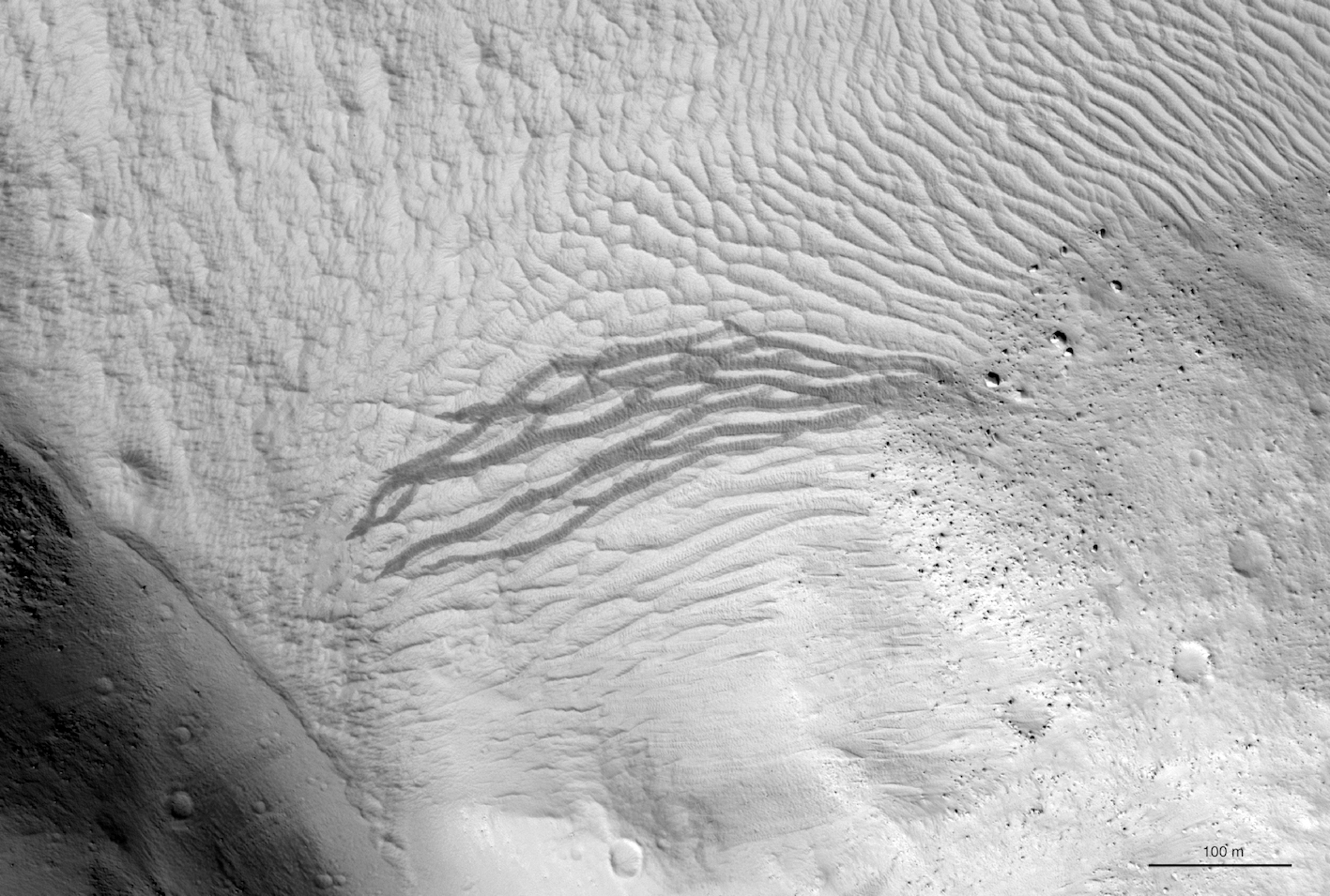
Anjani Polit wrote:Meandering Slope Streak (ESP_022991_2070)
This dusty region of Mars has many slope streaks, which are thought to form when dust cascades down a slope. In some cases it is possible to pinpoint what destabilized the slope and triggered the avalanche of dust, such as this slope streak which was triggered by a small impact event, or this slope streak, which appears to have been triggered by a dust devil.
Slope streaks generally begin at a point and widen downslope, but they are affected by the terrain and can be diverted, as shown here, where two slope streaks were diverted around a crater.
This observation shows a very unusual slope streak. Almost from its point of origination, the slope streak splits up into many fingers that appear to wind their way through the terrain, diverting around slight topographic highs. This unusual slope streak was first imaged by the Mars Orbiter Camera in the year 2000.

Kristin Block wrote:Remains of Summer at the South Pole (ESP_023174_0945)
This image captures the margin of the South polar residual ice cap where it meets the surrounding terrain. It was taken during the end of the Mars Southern hemisphere summer.
Towards the north (left in the map-projected image), what is informally referred to as "Swiss cheese terrain" can be seen. This is thought to be formed as frozen carbon dioxide periodically sublimates (turns from solid directly to gas as the area warms).
Where the dust and ice meet, the dramatic color difference between these two materials serves to highlight a small area of polygonal cracking. Further south, the carbon dioxide ice has given way to more familiar, dusty Mars terrain, here organized in layers.
... Previous images from this area can be found here: ESP_012559_0945, ESP_014273_0945, ESP_014405_0945

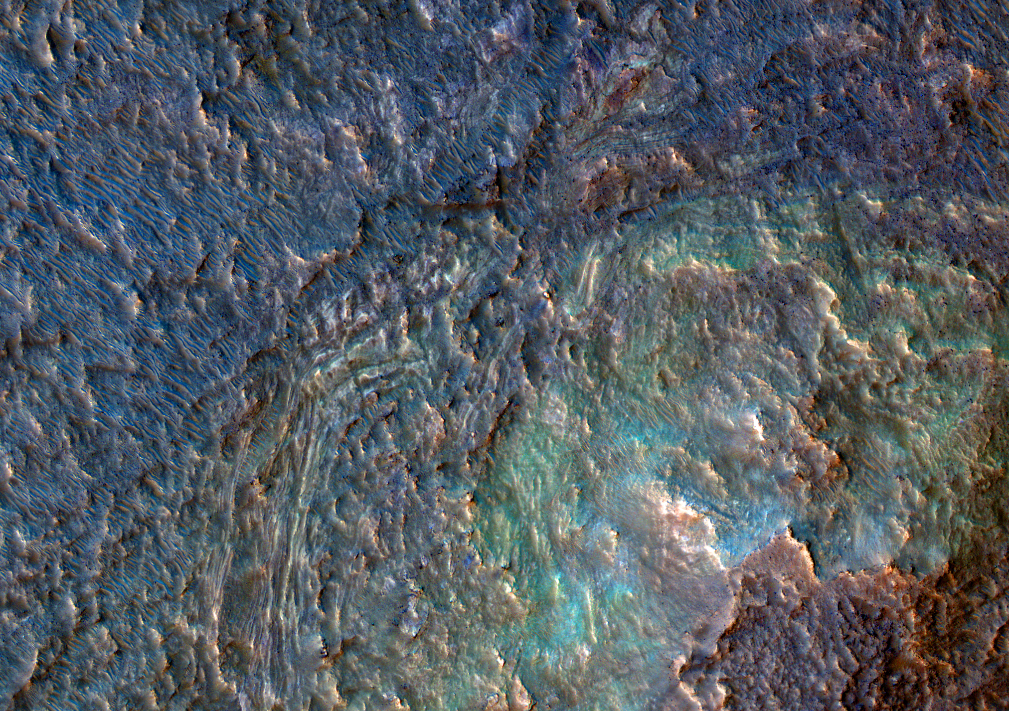
Alfred McEwen wrote:The Crazy Floor of Hellas Basin (ESP_023234_1460)
The deep floor of Hellas impact basin is often obscured by haze, but at times we get some clear views. There are some strange landforms down there, and this image is one example.
The image covers the rim region of a crater that appears filled in, perhaps by river sediment (the rim is breached by a channel). The colors (see enhanced color subimage) indicate that diverse minerals are present.

Credit: NASA/JPL/University of Arizona
<< Previous HiRISE thread
